
Unstan stalled cairn, Stenness

By Sigurd Towrie

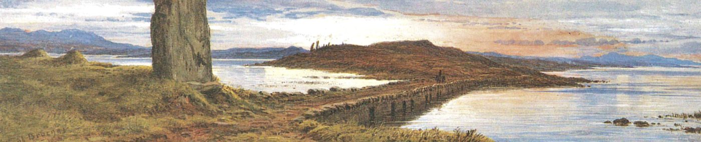
The Knowe [1] of Onston [2] is a large mound on a headland that juts into the Stenness loch.
It lies on the Ness of Onston, a short distance from the Brig o’ Waithe, where the loch meets the sea, and directly east of the Deepdale standing stone.
In the late 19th century, the knowe attracted the attention of Robert Clouston, one of the many antiquarians with their sights on Orkney’s suspected ancient monuments.
It was opened in July 1884 and found to contain the remains of a Neolithic stalled cairn. [3]
The stalled cairns – or Orkney-Cromarty, to use their typological name – are made up of rectangular chambers divided in to “stalls” or compartments by pairs of large orthostats. [4]
Covered by round or rectangular cairns, the interiors often incorporate shelf- or bench-like features and end chambers dominated by large, monumental back slabs.
The Unstan cairn, as it is now more commonly known [5], is oval in plan with an exterior not unlike a smaller version of Maeshowe, around 2.5 miles to the north-east.
Sticking strictly to accepted typology, Unstan does not fit neatly in either of the two styles of Neolithic chambered cairn found in Orkney [6]. Instead it is a hybrid, incorporating elements of both.
Although it has the rectangular, stalled chamber of the Orkney-Cromarty type, it also has a Maeshowe-type side-cell and is accessed by a long passage akin to that style.


Unstan’s long, low and narrow entrance passage is accessed from the eastern side. At 6.5 metres long, and between 40 centimetres and 60 centimetres wide, it leads into a 6.6-metre-long sub-rectangular chamber.
The passage – the longest of any known Orcadian stalled cairn – is at right angles to the chamber and not centrally placed – presumably to avoid the side-cell branching out from the central compartment on the opposite wall.
The interior, which is c.1.52m at its widest and tapers at each end, is divided up by four pairs of large stone slabs projecting from the side walls.

These orthostats create five compartments – three central stalls and two end sections – and form a central, stone-flanked passageway along the length of the chamber.
The end chambers have the massive back-slabs typical of the Orkney-Cromarty style and, c.1.2 metres from the floor, stones projecting from the swalls were probably to support a “shelf” or “bench”, akin to those within other stalled cairns, e.g. Midhowe, Rousay.
There was no evidence of these during excavation, suggesting they had either broken, were not recognised or perhaps had been wooden and rotted away.
Both end chambers are have low threshold stones between the dividing orthostats.
White clay had been laid as a floor surface and was overlain, in the southern end, by a layer of black material, rich in charcoal.
Among the unburnt bone were “chips and flakes” of flint showing “indubitable indication of the action of fire.” [3]

In the centre of the western wall is the small side cell. Unstan and South Ronaldsay’s Isbister Cairn – better known as the Tomb of the Eagles – are the only two excavated cairns in Orkney to feature both stall and side-cell architecture.
Unstan was the first cairn opened in the 19th century to produce finds in any quantity. It was also (and remains) one of the few in Orkney found to contain human skeletal material. [7]
On the floor of every compartment the excavators recorded a “considerable quantity” of burnt and unburnt bone – both human and animal.
Among the disarticulated remains were complete skeletons – two crouched inhumations in the western side chamber and “several burials in the contracted posture” on the floor of the entrance compartment. [3]
The bone assemblage was not studied at the time and only a few survive, so we do not know how many bodies were represented.
The animal bone was said to comprise of horse, cattle, sheep, pig, dog, birds and deer. [3]
Graffiti

As well as clearly modern graffiti, the interior of Unstan has a number of faint, rune-like marks and incisions. The most notable, although difficult to see today due to algae, is a deeply-cut depiction of a diving bird on the lintel above the side-cell entrance.
The hill to the left and the diving position of the bird suggests the picture represents the Stenness loch with the hills of Hoy in the background. A crude inscription to the left declares it to be “Pictish marks” but that is highly unlikely. The fact none of the graffiti, particularly the prominent bird, were noted during excavation suggests they post-date it and must date from the late 19th or early 20th centuries.

Unstan Ware

At the time of excavation Unstan contained an unusually large quantity of pottery sherds – the fragments from at least 30 bowls. [3]
The sherds were mostly in the entrance compartment although a few were encountered elsewhere in the chamber, including the access passage.
It is notable, however, that the side-cell was devoid of pottery.
The pots were large, shallow, round-bottomed and with incised motifs beneath the rim. Their shape and decoration saw the ceramic style named Unstan Ware and regarded as representative of Orcadian pottery in the Early Neolithic.
Unstan Ware was long thought to have been supplanted, around 3200BC, by Grooved Ware.
However, a 2017 re-analysis of Orkney radiocarbon and luminescence dates now suggests that “round-based pottery […] and Grooved Ware […] were almost certainly in contemporaneous use during the thirty-first century cal BC, at the very least.” [8]
Until Unstan Ware was found at the Knap of Howar it had only been found in funerary contexts in Orkney.
These two stone buildings in Papa Westray were originally thought to date to c3700-3600BC but re-dating has now placed the first activity on site around 3500BC and the erection of the structures we can see today around 3300BC. [8]

Dates

Until 2017, all that could be said about Unstan was that, based on the pottery found, it dated from the Early Neolithic.
That changed following a programme of radiocarbon dating of material held by National Museums Scotland. Three fragments of unburnt human bone from the 1884 excavation were analysed and returned dates around 3300-3100BC. [9]
That, however, does not mean the chambered cairn was constructed at that time. It may be centuries older and cleared out or re-used at regular intervals.
What it does tell us is that the chamber was standing and in use by c3300BC.
The presence of Unstan Ware pottery and Early Neolithic arrowheads in the chamber together with Bronze Age material (a barbed-and-tanged arrowhead was found within the entrance passage [3]) suggests the cairn was a focus of at least episodic attention for a millennium.
After excavation, and with their artefacts secure, the antiquarians departed, leaving the structure to the mercy of the elements for almost half a century.
It was taken into state care in 1934 and, in 1949, the remains consolidated and a concrete roof added.
The ‘promontory fort’

North of the stalled cairn is an enigmatic earthwork that separates the landward side of the Ness of Onston from the headland.
The arc of two banks and ditches runs across the width of the headland, demarcating an area to the north that is now devoid of visible archaeological remains.
Various theories have been proposed over the years, the most common being that the enclosure dates from the Iron Age.
Although it now officially classed as a “promontory fort”, little is known about the feature, not least its age. Was it contemporary to the Unstan cairn or a much later addition? Enclosing and containing areas – particularly funerary – using ditches and banks, not to mention walls and standing stones, is well known in the Orcadian Neolithic. It is, however, also a feature of the Iron Age.
Following a visit in 1928, the Royal Commission on the Ancient and Historical Monuments of Scotland (RCAHMS) wrote:

By 1966, these “ramparts and ditches” were:
Enough survives today to make it clear that whoever decided to seal off the headland went to a great deal of trouble to do so.
Both ditches were three metres wide, with the material removed during their digging used to create parallel banks. These survive to a maximum height of c.60cm.
There are easier ways to fence-off an area, which suggests the construction went beyond mere practicality.
The oft-repeated theory that the earthworks defined a livestock enclosure doesn’t really stand up to scrutiny. Not only is a double line of ditch and bank overkill for this, but the shallow water around the lochside would be no barrier to animals. That said, aerial photographs (see above) over the years have suggested that the route of the ditches and banks continued under the waters of the Stenness loch.
If that were the case it not only meant the enclosed area was once larger but pre-dated the water levels in the loch reaching their present level.
However, survey work by the Rising Tides project in 2011/2012 – both onshore and offshore – did not find evidence that the earthwork extended beyond the current shoreline.
However, the surveyors concluded that had it been larger:

In 2007, the Ness of Onston was geophysically surveyed as part of a UHI Archaeology Institute project looking at the entire Orkney World Heritage Site and its environs.
The resistivity results clearly showed the path of the ditches and banks. They also revealed anomalies in the enclosed area, which may represent the remains of stone structures. Magnetic survey, however, did not detect any definite features, suggesting the enclosure’s primary role was not settlement. [12]
As always it will require excavation to answer the question as to what the Onston earthwork defined.
As Hugh Marwick put it in 1952:
Notes
- [1] Orcadian dialect term for mound, tumulus. Interchangeable with howe (Old Norse haugr, meaning burial mound, cairn).
- [2] The element -ston in Orcadian placenames usually represents sta∂ir, meaning dwelling-place, farm. In most cases the first element is a personal name. In this case, that first element is not known.
- [3] Clouston, R. S. (1885). Notice of the excavation of a chambered cairn of the Stone Age, at Unstan, in the Loch of Stennis, Orkney. In Proceedings of the Society of Antiquaries of Scotland (Vol. 19, pp. 341-351).
- [4] The stalled architecture is paralleled at the Ness of Brodgar complex, stone slabs dividing the interior of Structure Five and the projecting piers serving the same role in the later structures.
- [5] Unstan/Onston/Unston are just three of a number of spellings for the same placename. Recorded as Onsta in 1546; Onestone in 1576; Unstane in 1595 and Unstoun in 1627. Like Bookan in Sandwick, variants of the same name can still be found in the same area. Although the written names differ, the pronunciation is usually the same.
- [6] Orkney-Cromarty type and Maeshowe-type.
- [7] Crozier, R. (2016) Reorientating the dead of Crossiecrown: Quanterness and Ramberry Head. In Richards, C. and Jones, R. (2016) The Development of Neolithic House Societies in Orkney: Investigations in the Bay of Firth, Mainland, Orkney (1994–2014). Oxford: Windgather Press, 196-223.
- [8] Bayliss, A., Marshall, P., Richards, C. and Whittle, A. (2017) Islands of History: The Late Neolithic timescape of Orkney. Antiquity, 91(359), pp. 1171–1188.
- [9] Sheridan, A., Cook, G., Naysmith, P., Tripney, B., Dunbar, E., Reich, D., Olalde, I., Armit, I., Hunter, F.J., Farrar, S. and Ritchie, G. (2017) Radiocarbon dates associated with the Scottish History and Archaeology Department, National Museums Scotland, 2016/17. Discovery and Excavation in Scotland, 18, pp.209-14.
- Davidson, J. L. & Henshall, A. S. (1989). The Chambered Cairns of Orkney. Edinburgh: Edinburgh University Press.
- [10] https://canmore.org.uk/site/1710/point-of-onston
- [11] Bates, R., Bates, M., Dawson, S.. and Wickham-Jones, C. (2012) Rising Tides project: Geophysical Survey of the Loch of Stenness, Orkney.
- [12] Brend, A., Card, N., Downes, J., Edmonds, M. and Moore, J. (2020) Landscapes Revealed: Geophysical Survey in the Heart of Neolithic Orkney World Heritage Area 2002-2011. Oxbow Books, Oxford.
- [13] Marwick, H. (1952) Ancient Monuments in Orkney. HMSO: Edinburgh.


