
Ness flanked by lochs in prehistory? Surveys suggest otherwise

By Sigurd Towrie
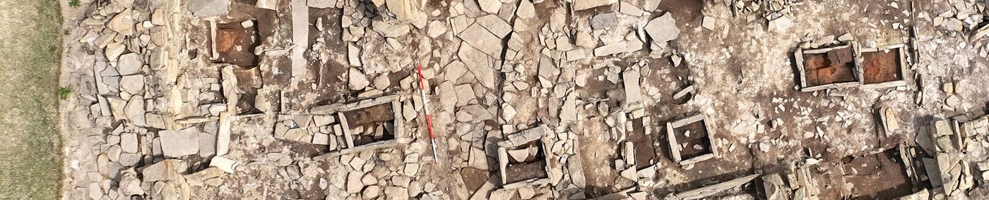
Standing on the Ness of Brodgar, you can see why the peninsula was chosen to site some of the best-known ceremonial monuments of the Orcadian Neolithic.
The Ness sits at the centre of a massive natural “cauldron” formed by the hills of the surrounding landscape. Today, it is accentuated on either side by the freshwater Loch of Harray and the saltwater Loch of Stenness – but that was not always the case.

Around 3700BC, when the first farmers arrived in Orkney, the islands were much as today but there was a major difference.
Sea levels, which had been rising throughout the Mesolithic, continued increasing in the Neolithic, only reaching present heights around 2000BC.
As such, there were swathes of low-lying land in the Neolithic that are now under water.
One of these areas is the basin now occupied by the Loch of Stenness.
Extensive survey work carried out as part of The Rising Tide Project* suggests that when construction first began on the Ness complex the loch – which is now connected to the sea – was considerably smaller, partially brackish and perhaps surrounded by areas of wet, marshy bog surrounding pools of water.
A smaller loch naturally meant the Brodgar isthmus was much wider – at least 50 per cent greater on the Stenness side and perhaps the same on the Harray loch side.
Areas of now submerged rock on the western side may also have provided an accessible source of building material for the constructions on the Ness.
As the sea made inroads, the water became increasingly saline and the Stenness loch grew in size, flooding lower areas and encroaching on the Ness. The survey data suggests the loch reached its current size around 2000BC – some 500 years after the abandonment of Structure Ten at the Ness complex.

Because the Loch of Stenness is now joined to the Harray loch at the Brig o’ Brodgar, lower water levels in the former could mean the latter was also much smaller.
If this was the case, the tip of the Ness of Brodgar peninsula was perhaps dry land, or at least damp, marshy ground, connecting Mainland Stenness to the isthmus.
Over the years much has been made of the Ness being flanked by the saltwater and freshwater lochs and the interaction between land, water and sky. Does the evidence of smaller lochs lessen the significance of the area?
One look at the archaeology suggests not.
In fact, being bounded on both sides by low-lying boggy ground may have enhanced it.
Not only would the Ness have been more prominent in relation to the low ground on either side but would have remained a “liminal” place – on the edge of two worlds and bounded by neither wet nor dry land.
The significance of water in the Neolithic has been highlighted by numerous archaeologists over the years – with the clear relationship between monument sites and watercourses a common thread.
Water was the means by which people travelled around Neolithic Orkney and also structured how they moved around the islands.
Although the deposition of objects into “watery places” such as rivers, lakes and bogs is commonly regarded as a Bronze and Iron Age phenomenon, Professor Colin Richards has highlighted that “considerable amounts” of Neolithic material were also deposited into, or near, water.
With the possibility that the majority of bodies in the Neolithic were also being placed in water, the element perhaps had a symbolic association with the transformation between living and dead – a watery journey into the realms of the ancestors.
The potential links between water and the disposal of the dead, it has been suggested, may lie behind an apparent lack of fish in the Neolithic diet.

Floating stones?

For centuries, people have obsessed about how the megaliths for the Stenness and Brodgar stone circles could be moved from their quarry sites to the Ness.
But while hauling the quarried stones would undoubtedly have required effort, the recurring idea it was a nigh-impossible feat is considerably off the mark.
Massive stones were moved manually in Orkney until the advent of mechanised transport in the 20th century. Although perhaps not on the same scale as the Neolithic megaliths there is no mystery as to how these stones were moved.
It was simply organisation, hard work and common sense.
But the movement of megaliths continues to be debated.
One common suggestion is that the stones were ferried across the lochs – a decades-old theory based on the assumption the loch sizes were the same in the Neolithic as they are now.
We now know this is unlikely for the Loch of Stenness and although we do not yet have definite data for the Harray loch the idea of water transport is highly unlikely.
Which leaves us with a puzzle.
According to local tradition, the Loch of Harray is home to abandoned standing stones – megaliths, so the story goes, that were lost during transport and which sank to the bottom.

The number and location of these stones varies according to anecdote and what lies behind them remains unclear.
The survey of the Stenness loch, however, hinted at the presence of submerged archaeology that, if confirmed, may also lie at the root of the Harray “sunken stone” legends.
These underwater anomalies will have to be fully investigated before we can say for sure they are not just natural geological features, but it is not impossible that the remnants of constructions on what was the outer edges of the Ness now lie beneath the waters of both lochs.
- * Bates, C.R., Bates, M.R., Dawson, S., Huws, D., Whittaker, J.E. and Wickham-Jones, C.R. (2016) The environmental context of the Neolithic monuments on the Brodgar Isthmus, Mainland, Orkney. Journal of Archaeological Science: Reports, 7, pp.394–407.


