
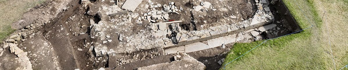
The Ring of Brodgar
Instructing the quarrymen and masons of Brodgar.
In the purity and inevitability of stone-setting.”

By Sigurd Towrie

With a diameter of 103.6m, the Ring of Brodgar is the larger of the two stone circles in the Heart of Neolithic Orkney World Heritage Site and one of the biggest in the British Isles.
Compared to the megaliths within the Stones of Stenness, a mile to the south-east, the Ring of Brodgar’s are smaller, varying in height from 2.1 metres to a maximum of 4.7 metres.
Although only 27 remain it has long been proposed – and still is regularly – that, based on the spacing of the surviving stones, the circle once contained 60.
But, in 2008, geophysical survey suggested otherwise.
The tomographic survey focused on the south-eastern half of the ring and located an additional 19 possible socket holes. Including the surviving stones and stumps this meant 36 stones once stood in that section.
Assuming the same applies to the other half, this suggests the Ring of Brodgar may have been made up of more than 70 megaliths, but – and this is an important point – not necessarily at the same time.

Enclosed by a rock-cut ditch, access to the ring’s interior is by two opposing causeways. The south-eastern entrance is just over a metre wide, narrow compared to its 3.4-metre-wide north-western counterpart.
We do not have secure dates for the ring but it is generally thought to be later than the Stones of Stenness and from between 3000BC and 2500BC.
Dates from the ditch, however, suggests it was dug between 2600BC and 2400BC. But, like Maeshowe, we cannot assume the ditch and the stone circle were contemporary. Was the ditch dug first or at the same time stones were being erected? Or was it a much later addition? Perhaps to enclose the site after the significance of the ring waned?


A ring of stones

In light of the discoveries at the Ness of Brodgar complex, the long-held notion that a single, elite individual or group was responsible for the construction of the Ring of Brodgar has to be questioned.
Just as we suspect the Ness was a meeting place – a location where people gathered from all over Orkney and perhaps beyond – the same may be true for the stone circle.
And just as the Ness site was an ever-changing, evolving site for centuries, perhaps we should stop looking at the stone circle as the end result of a single, planned construction event.
Constant change

There is a tendency to look at sites such as the Ring of Brodgar and Stones of Stenness and regard them as “completed” monuments. Someone in the Neolithic decided to erect a stone circle and set a plan in motion to create a finished, final product.
But it has been argued that there was no end goal — no finished monument to work towards and no timescale.
Instead, the erection of stones at the Ring of Brodgar may have taken place over generations, the composition and appearance of the stone circle constantly changing as megaliths collapsed, were added, removed or replaced.
If it was an ever changing monument, and never meant to be complete, it may have looked much the same in the Neolithic as it does today – single, paired and clusters of megaliths separated by gaps of varying sizes. [2]

To the team who excavated at the ring in 2008, it was not the completed stone circle that was significant to its builders but the physical act of its creation. [2]
The goal, they proposed, was not a finished “product”.
Instead, the prestige of quarrying, transporting and erecting a fine megalith was the driving force behind the development of the Ring of Brodgar.

Geological examination of the Brodgar stones confirmed they came from at least seven different quarries and were transported to the site from across Orkney. [2]
Did these different quarries, and the stone obtained from them, represent different Orcadian communities?
The fact the different rock types in the ring are clustered together [2] certainly suggests so, with different sections of the stone circle perhaps relating to the different social groups who came together to raise the megaliths.
Professor Colin Richards has suggested these communities – although they worked together – were fiercely competitive. The Ring of Brodgar was an arena where they attempted to outdo each other with visible shows of prestige and power.
A far cry from the harmonious Neolithic “temple” the ring is often proclaimed as today.


Built to endure?
Survey in the Heart of Neolithic Orkney World Heritage Area (2020)


The 2008 excavation at the ring also revealed something surprising – the socket holes for the Brodgar stones were incredibly shallow.
Two were excavated and measured a mere 27cm and 18cm deep. [2]
Compare that to those encountered at the Stones of Stenness, which were between 90cm and 1.3m deep. [3]
Clearly, despite the effort put into quarrying and transporting the megaliths, they were not erected to endure. As Professor Mark Edmonds put it:
Instead of permanence, it seems that appearance, and the illusion of grandeur, was paramount.
Evidence of this came from the 2008 tomography scans. These showed that the broader megaliths at the causeways were placed closer together, creating the illusion of a massive stone circle to those approaching the entrances.

We can see something similar in the structures at the Ness of Brodgar, where appearance seems to have been more important than structural stability.
At the ring, was the erection of a stone temporary?
To be replaced or removed at a later date?
Or were they put up and left to decay and collapse? We cannot say. What is clear, from the current evidence, is that the builders do not seem to have been concerned about permanence.
The site

We cannot be sure why the site for the Ring of Brodgar was chosen, but it seems very likely that it was considered significant – perhaps for a number of reasons.
There were better places to erect a stone circle – more visually prominent sites, for example, that did not require the builders to mine through bedrock. But as we will see, perhaps the easy option was not the best one.
We have discussed elsewhere that the ring may have monumentalised and enclosed an earlier pathway along the Ness of Brodgar. The fact the stone circle has two opposed access causeways certainly suggests that movement through the monument, and along the peninsula, was an important element.
The ditch


Like the Stones of Stenness, the Ring of Brodgar is classed as a henge monument – despite the fact it has no outer bank and, going on current evidence, probably never did.

What it does have is a massive encircling ditch.
Cut from solid rock using nothing but antler picks, stone tools and sheer effort, the 123-metre diameter ditch surrounding the circle of stone, was originally over four metres deep and ten metres wide at ground level. [2]
An estimated 4,700 cubic metres (11,000 tonnes) of rock had to be quarried to create the 386-metre-circumference ditch — a task estimated to have taken 80,000 hours. [5]
Two sections of the ditch were excavated in 2008 and revealed the sheer scale of the undertaking. It was deep, broad and flat bottomed and not dug in one continuous process.
Instead, it was clear that the ditch had been dug in segments – perhaps over many years and involving different groups of people. [2]
Were those the same people who brought in the stones to site responsible for digging their own segment of the ditch? Or their descendants?
As always with ditched monuments there is the question of where the ditch sits in the biography of the site. Were the megaliths erected before or after the ditch was cut?
Over the years, the assumption was that the standing stones must have been first, and the ditch dug around them. The reason? Efficiency – it would be easier to move the stones into position before a massive ditch was dug.
The danger here, however, is assuming that the Neolithic people wanted to make things easy. The modern mindset is focused on speed and economy of effort – what is the easiest, cheapest and quickest way of getting a job done?
If the construction of the stone circle, rather than the completed monument, was important, it could be that the harder the task the more significant the action.
And when it comes to ditch, there is no doubt its creation was a monumental task.

That said, dates from the 2008 excavation suggest the Ring of Brodgar ditch was dug between c2600-2400BC, and shortly afterwards began to quickly silt up. [2]
This suggests the monument had gone out of use and fits with the idea of the ditch being a final addition, perhaps enclosing and sealing off the site.
It is interesting to note that the ditch around Maeshowe was dated to around 2700BC.
Quarrying the stones


Numerous published accounts of the Ring of Brodgar have claimed that some of the Brodgar megaliths were quarried from the surrounding ditch.
Modern excavation, however, has shown this could not have been the case – the geology of the rock means that a complete standing stone could not have been extracted from the ditch without breaking. [6]
So, if they did not come from the ditch, where were they from?
We have seen that the geology of the surviving stones point to at least seven different quarry sites. This corroborates centuries-old, local beliefs that multiple quarries were the source of the stone circle megaliths.

One of these traditional sites is Vestrafiold, a hill in the neighbouring parish of Sandwick, overlooking the Bay of Skaill and Skara Brae.
Behind the tradition is the fact that on Vestrafiold were at least two quarried, but abandoned, standing stones. [6]
Excavation between 2001 and 2003 not only confirmed that megaliths were being extracted from outcrops on the hill but provided an unparalleled insight into the Neolithic quarrying process. [6]
Among the conclusions drawn from the fieldwork was that specific quarries were exploited for megaliths – perhaps places imbued with a special significance or role in the cosmology of the local communities. [7]
Early accounts


The Brodgar ring was first recorded in the early 16th century, by the enigmatic author Jo Ben:
The brief description of the ring appears in the 1529 Descriptio Insularum Orchadiarum, the oldest surviving account of the Orkney islands after their transfer to Scotland in 1468.
As you will see, Jo Ben makes no mention of the number of stones but, by 1792, the ring contained 16 standing stones, with eight lying prone [8].
By 1848, only 13 remained upright while ten lay “nearly perfect, but prostate” along with the “stumps or fragments of thirteen more”. [9]
The Ring of Brodgar was taken into state care in 1906 and, two years later, most of the fallen stones were placed in what was thought to be their original sockets.
Since then two stones have suffered lightning strikes, leaving 27 standing today.
‘The temple of the sun’

Until the middle of the 19th century, the Brodgar ring was lumped in with the rest of the area’s megaliths and all known collectively – to antiquarians and mapmakers at least – as the “Standing Stones of Stenness”.
It was in 1851 that the name “Ring of Brogar” is first recorded.
Seeking to differentiate between the two stone circles, Lieutenant F.W.L. Thomas [9] dubbed the “lesser stone circle” of Stenness, “for the sake of distinction, the “Ring of Stenness”, while referring to the “Great Stenness circle” as the “Ring of Brogar”. [10]

In the same year, Daniel Wilson referred to “Great circle, or Ring of Broidgar [sic], as it is most commonly styled.” [8]
Brodgar (Brogar/Broidgar) comes from the name of the nearby farm, which is Old Norse brúar – bridge and garðr – farm.
It seems likely these two chroniclers were using the local name for the stone circle, particularly because the majority of accounts before (and even afterwards) repeated the antiquarian’s favourite – the “Temple of the Sun”.
This title, along with the “Temple of the Moon” for the Stones of Stenness, can be traced back to Martin Martin’s late 17th century account, in which both stone circles are described as temples and states:

One wonders who these “several inhabitants” were and whether they, or Martin himself, were influenced by the ideas of “druidic temples” that were beginning to drift up from the south [13].
As Wilson put it in 1851:
The sun and moon temple titles, that had become firmly entrenched in the literature by the middle of the 19th century, prompted Wilson to declare that there was no doubt these “frequently designated” designations were “quite modem and spurious”. [8]

Elements of Martin’s account are remarkably similar (and probably copied from) to Rev James Wallace’s 1693 A Description of the Isles of Orkney.
Wallace, however, actually lived in Orkney and it is perhaps telling that he did not assign the temple label to the two stone circles. Nor did he mention of any tradition of sun or moon worship. Probably because it did not exist.
To close, we should look at an interesting reference made by the folklorist and historian George Marwick in the late 19th century.
Marwick, a resident of the neighbouring parish of Sandwick, lived a few miles from the Ring of Brodgar. He proclaimed there was an old, and all but forgotten, name for the stone circle – Howastedgarth. [14]
We will consider that next time.
Notes
- [1] Richards, C. (2004)
- [2] Downes, J., Richards, C., Brown, J., Cresswell, A.J., Ellen, R., Davies, A.D., Hall, A., McCulloch, R., Sanderson, D.C. and Simpson, I.A. (2013) Investigating the Great Ring of Brodgar, Orkney. In Richards, C. (ed) Building the Great Stone Circles of the North, pp.90-118.
- [3] Ritchie, J.N.G. and Marwick, E.W. (1975) The Stones of Stenness, Orkney. In Proceedings of the Society of Antiquaries of Scotland (Vol. 107, pp. 1-60).
- [4] Edmonds, M. (2019) Orcadia: Land, Sea and Stone in Neolithic Orkney. Head of Zeus Ltd.
- [5] Renfrew, C. (1979) Investigations in Orkney. Pg 213.
- [6] Richards, C., Brown, J., Jones, S., Hall, A. and Muir, T. (2013) Monumental Risk: megalithic quarrying at Staneyhill and Vestrafiold, Mainland, Orkney. In Richards, C. (ed) Building the Great Stone Circles of the North. Pg 123.
- [7] Richards, C., Downes, J., Ixer, R., Hambleton, E., Peterson, R. and Pollard, J. (2013) Surface over substance: the Vestrafiold horned cairn, Mainland, Setter cairn, Eday, and a reappraisal of late Neolithic funerary architecture. In Richards, C. (ed) Building the Great Stone Circles of the North. Pg 149-183.
- [8] Wilson, D. (1851) The Archaeology and Prehistoric Annals of Scotland. Pg 106.
- [9] Thomas, F.W.L. (1851) Account of some of the Celtic Antiquities of Orkney, including the Stones of Stenness, Tumuli, Picts-houses, &c., with Plans, by FWL Thomas, RN, Corr. Mem. SA Scot., Lieutenant Commanding HM Surveying Vessel Woodlark. Archaeologia, 34(1), pp.88-136.
- [10] The ring and the isthmus take their names from the farm, Brodgar, the earliest record of which dates to 1563. Documented as Broager, this derives from the Old Norse brúargarðr, meaning bridge farm. The written form “Brodgar” is closer to the Orcadian pronunciation.
- [11] Martin, M. (1695) A Brief Description of the Isles of Orkney and Schetland.
- [12] Hibbert, S. (1823)The Tings of Orkney and Shetland. Archaeologica Scotica VIII.
- [13]John Aubrey’s Monumentica Britannica was written between 1663 and 1693 and its first section, Templa Druidum, outlined his thoughts on the “druidic temples” of Avebury and Stonehenge.
- [14] Marwick, G. (1892) Howastedgarth, The Standing Stones, Stennis. In Muir, T. and Irvine, J. (eds) 2014. George Marwick: Yesnaby’s Master Storyteller. The Orcadian. Kirkwall.


