
Maeshowe
including the Stones of Stenness, Tumuli, Picts-houses, &c., with Plans. (1851)

By Sigurd Towrie

Probably the best-known Neolithic chambered cairn in Orkney, Maeshowe stands less than a mile to the east of the Ness of Brodgar complex.
But although Maeshowe gave its name to a specific type of Orcadian chambered cairn, it differs considerably from the others in its “class”.
For one, it is the largest and most elaborately constructed, but, more obviously, the entrances to its three side cells are elevated – raised above the floor in the centre of the chamber’s north, east and western sides.
In addition, it stands out “because of the completely atypical use of standing stones in its construction.” [1b]
Appearing today as a grassy mound, the 5,000-year-old structure dominates a low, gently sloping plain to the east of the Harray loch.
Beneath the clay and rubble mound is a large, high-roofed chamber with three side-chambers in the north-east, south-east and north-west walls. This chamber was reached via a long, low and narrow entrance passage on the south-western side.
The structure stands on an artificial platform and surrounded by a ditch and bank/wall [1], creating an oval enclosure c.106 metres by 93 metres. Maeshowe’s enclosure, however, had no causeway across the ditch, prompting questions about access. Was the chamber enclosed to keep people out or something in?
Excavation
Maeshowe was opened in 1861, the explorers breaking in through the roof. Leading the operation was the notorious antiquarian James Farrer – “an assiduous if, by modern standards, unscientific digger of mounds”. [2]
Farrer was very active in 19th century Orkney and as notable for the damage he caused as his lack of documentation.
Fortunately, he was often accompanied, or followed, by the Orcadian antiquary George Petrie, who on at least one occasion politely urged Farrer to moderate his activities. [3]
Recording the attempts to get into Maeshowe, Petrie explained:

The ten-metre-long entrance passage slopes slightly downwards towards the exterior and is divided into two sections by a door jamb about six metres from the mound’s perimeter.
The outer passage is narrower and lower than the inner section and was probably ruinous when the passage was cleared in 1861. All but a two-metre section of the outer passage was found to be unroofed.
To Petrie the roof slabs had been removed [3] while John Stuart’s 1864 account of the excavation stated they had fallen in. [5]
The innermost surviving section of the outer passage was roofed at a height of 70cm, so it was assumed that the rest of the passage had been the same.

The ruinous condition of the outer section, however, means the form of the original entrance is not at all clear.
It has been suggested that at least part of the outer passage took the form of an open trench [6], much as it appears today.
Just beyond the door jambs, in the north side of the inner passage is a triangular alcove that now houses a large stone.
The triangular stone, which is only slightly narrower than the width of the passage, fitted perfectly into the recess:
Anyone who has seen the size of the stone will agree that moving it in and out of the entrance could not have been an easy task – a fact that has led to the suggestion that Maeshowe was never intended to be entered – or at least not regularly.
To others, the position of the door jambs in relation to the blocking stone suggests the passage was sealed from the inside.
After bending double to negotiate the entrance passage, the main chamber unfolds as a vast expanse of space.
In 1861, the excavators found it to be:
“After a few days labour,” wrote Farrer, “the whole of the rubbish filling the chamber was removed”. [7]
Farrer’s so-called “rubbish” hastily extracted, the excavators found a well-built square chamber, 4.7 metres across, with side chambers in the centre of each of the three walls facing the entrance.

Maeshowe differs from other chambered cairns in that the side cells are not at ground level but about 80cm from chamber floor. A single large stone lies outside each of the cells, thought to have been used to seal the chambers.
Once inside Maeshowe’s chamber, the skill of the Neolithic builders becomes immediately apparent. The quality of the drystone stonework is impeccable.
The walls rise vertically to a height of 1.4 metres before they begin to slope inwards to finish in a corbelled roof. The height of the original roof is not known, although it could have been anything from 4.5m to 6m high. Maeshowe’s present roof is a modern one, installed in 1910, when the monument was taken into state care.
Standing stones

Among the features that set Maeshowe apart from other Orcadian chambered cairns are the standing stones incorporated into its architecture.
Four can be seen in the central chamber – one in each corner – with another four lining the floor, walls and roof of the inner entrance passage.
The four in the central chamber are often described in the literature as buttresses, although they serve no architectural purpose. In fact, their presence was not only structurally unnecessary but may have impacted the stability of the corbelled roof. [1]
The megaliths were clearly a planned feature from the outset and the fact the chamber was built up around them means they must have been erected first.
For an unknown period, the four stood in the landscape as a square feature, until the construction of Maeshowe encased them in stone. Their inclusion may also explain the height of the chamber, with the roof corbelling only beginning above the tallest stone. [1]
Whatever they may have represented, or symbolised, physically they accentuate the scale of the chamber and draw the visitor’s eye upwards to the lofty roof. [8]
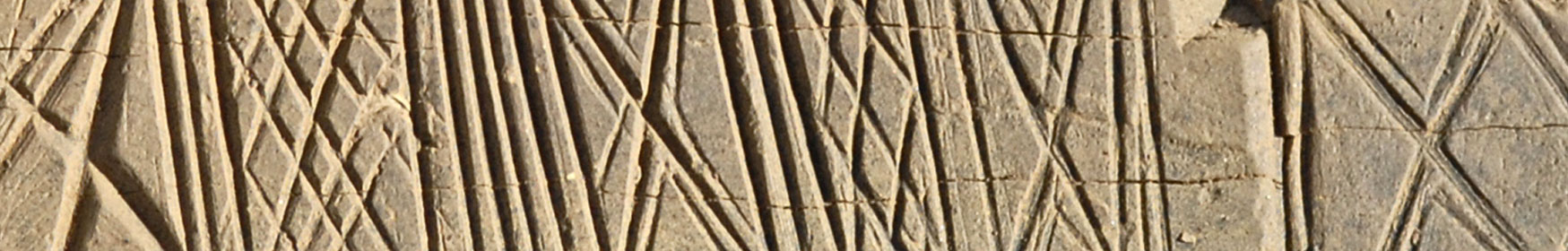
Given the areas decoration and embellishment noted within the chamber [9], one cannot help but wonder what sight greeted the Neolithic visitor.

The four megaliths incorporated into the inner section of the entrance passage are similar in shape and size to those forming the Stones of Stenness.
They are arranged, box-like, so anyone moving through the passage is, in effect, passing between standing stones – a motif that brings to mind the stone pairs within stalled cairns such as Unstan and Midhowe.
The inclusion of these large megaliths within the construction raises numerous questions, not least their origin.
Were they quarried specifically for the construction of Maeshowe? Or re-used from an earlier monument or stone circle?
Is the standing stone that once stood at the rear of Maeshowe now to be found inside?
Wherever they came from, one thing is beyond doubt – their inclusion linked Maeshowe to other sites on and around the Ness of Brodgar.
It has been argued that standing stones – whether single or in groups or rings – were associated with the dead. [1c]
If that were the case, it casts a whole new light on the use of megaliths within Maeshowe.
Were they considered representations of the dead? If so, it may explain the lack of skeletal remains found within the chamber when Farrer broke into it in 1861:
Dating Maeshowe

We do not know when Maeshowe was constructed, although these days it is generally accepted as being around 3000BC.
At some point in its life the chamber was enclosed by a wall and, around the same time, a ditch with no entrance causeway – additions that separated the monument from the surrounding landscape.
The only confirmed radiocarbon date from Maeshowe came from the enclosing ditch. This c2700BC date has become firmly attached to the chambered cairn, based on the assumption that the ditch and chamber were contemporary.
But as regular readers will know by now, we cannot assume that any monument – particularly those made up of multiple elements – was a single-phase construction.
With Maeshowe, we simply do not know whether the chamber, ditch and external wall were planned from the outset and built as part of a single, unified project.
Although there is little doubt the ditch was dug around 2700BC, it may have been added centuries after the chamber’s construction.

For decades it was suggested, and generally accepted, that Maeshowe-type cairns were a later “evolution” of the stalled Orkney-Cromarty cairns – stalled cairns came first, centuries before the advent of the Maeshowe-type.
This notion was dealt a blow in 2017, following a major reassessment of Neolithic radiocarbon dates from Orkney. This suggested both styles emerged in the middle of the fourth millennium BC (around 3700-3400BC) and remained in use, for the deposition of human remains, until around 2900BC. [10]
Is it likely that Maeshowe was built 200 years after the Orkney-wide use of chambered cairns ceased?

By modern standards, Farrer’s rush to clear out Maeshowe leaves a lot to be desired and explains why the published accounts differ on the scant quantity of human remains encountered.
Farrer himself makes no mention of any remains. Two years later, the Society of Antiquaries of Scotland heard there was a “small fragment of human skull” [4], while Orcadian antiquarian George Petrie referred to “several skull fragments”. [11]
Suffice to say there was not a huge quantity of bone and those recovered were subsequently lost. Hence the lack of radiocarbon dates.
Over a century later, however, another Maeshowe-type passage grave, a few miles to the east, was found to be packed with human remains. Quanterness was excavated in the 1970s and the re-analysis of radiocarbon dates now suggests it was continually in use from around 3400BC until 2900BC! [10]
If Maeshowe was constructed around the same time as Quanterness, it would be contemporary with the nearby Barnhouse Settlement and the piered buildings at the Ness of Brodgar. That this was the case, and that Maeshowe played a major role in the lives of the people of the Barnhouse settlement (c3200-2800BC), was proposed in 2005, based on architectural parallels between the two sites:
Notes
- [1] Challands, A., Muir, T. and Richards, C. (2005) The Great Passage Grave of Maeshowe. In Richards, C. (ed) Dwelling among the monuments: the Neolithic village of Barnhouse, Maeshowe passage grave and surrounding monuments at Stenness. Cambridge: McDonald Institute for Archaeological Research, pp. 229–248.
- [1b] Garrow, D., Raven, J. and Richards, C. (2005) Anatomy of a Megalithic Landscape. In Richards, C. (ed) Dwelling among the monuments: the Neolithic village of Barnhouse, Maeshowe passage grave and surrounding monuments at Stenness. Cambridge: McDonald Institute for Archaeological Research, pp. 229–248.
- [1c] Challands, A., Edmonds, M. and Richards, C. (2005) Beyond the Village: Barnhouse Odin and the Stones of Stenness. In Richards, C. (ed) Dwelling among the monuments: the Neolithic village of Barnhouse, Maeshowe passage grave and surrounding monuments at Stenness. Cambridge: McDonald Institute for Archaeological Research, pp. 205–227.
- [2] Ashmore, P. (2000) Maeshowe. Historic Scotland: Edinburgh.
- [3] Petrie, G. (1855) Description of antiquities in Orkney recently examined, with illustrative drawings. In Proceedings of the Society of Antiquaries of Scotland (Vol. 2, pp. 56-62): “Mr Farrer again visited Orkney last summer and resumed the excavations in Burray. I accompanied him to the island, and suggested the propriety of leaving the building undisturbed, and of the careful removal of the rubbish, both outside and inside.”
- [4] Petrie, G. (1861) Letter to The Orcadian newspaper. July 20, 1861.
- [5] Stuart, J. (1864) Notice of Excavations in the Chambered Mound of Maeshowe, in Orkney, and of the Runic Inscriptions on the Walls of its central Chamber. In Proceedings of the Society of Antiquaries of Scotland (Vol. 5, pp. 247-279).
- [6] Davidson, J.L. and Henshall, A.S. (1989) The Chambered Cairns of Orkney: an inventory of the structures and their contents. Edinburgh University Press.
- [7] Farrer, J. (1862) Notice of runic inscriptions discovered during recent excavations in the Orkneys. private circulation.
- [8] Edmonds, M. (2019) Orcadia: Land, Sea and Stone in Neolithic Orkney. Head of Zeus Ltd.
- [9] Thomas, A. (2016) Art and Architecture in Neolithic Orkney: Process, Temporality and Context. UHI Archaeology Institute Research Series: 1. Oxford, Archaeopress.
- [10] Bayliss, A., Marshall, P., Richards, C. and Whittle, A. (2017) Islands of History: The Late Neolithic timescape of Orkney. Antiquity, 91(359), pp. 1171–1188.
- [11] Marwick, H. (1931) Modern views of ancient Orkney. Proceedings of the Orkney Antiquarian Society 9, pp 9-16.
- [12] Thomas, F.W.L. (1851) Account of some of the Celtic Antiquities of Orkney, including the Stones of Stenness, Tumuli, Picts-houses, &c., with Plans, by FWL Thomas, RN, Corr. Mem. SA Scot., Lieutenant Commanding HM Surveying Vessel Woodlark. Archaeologia, 34(1).
- [13] Barnes, M. (1993) The Interpretation of the Runic Inscriptions of Maeshowe. Viking age in Caithness, Orkney and the North Atlantic : select papers from the proceedings of the Eleventh Viking Congress, Thurso and Kirkwall. Edinburgh University Press.
- [14] Somerville, A.A. and McDonald, R.A. (2014) The Viking Age: a Reader. University of Toronto Press.
- [15] Renfrew, C. (1979) Investigations in Orkney. Thames & Hudson.
- [16] Graham-Campbell, J. and Batey, C.E. (1998) Vikings in Scotland: an archaeological survey (p. 296). Edinburgh, UK: Edinburgh University Press.
- [17] Barnes, M.P. (1994) The runic inscriptions of Maeshowe, Orkney. Univ., Inst. för nordiska sprak.
- [18] Bradley, R., Phillips, T., Richards, C. and Webb, M. (2001) Decorating the houses of the dead: incised and pecked motifs in Orkney chambered tombs. Cambridge Archaeological Journal, 11(1).
- [19] Carr, R. (1868) Note on No. VII. of Mr George Petrie’s Copy of the Maeshow Runes. In Proceedings of the Society of Antiquaries of Scotland (Vol. 8, pp. 139-142).
- [20] Hibbert, S. (1823)The Tings of Orkney and Shetland. Archaeologica Scotica VIII.
- [21] Marwick, G. (1892) Howastedgarth, The Standing Stones, Stennis. In Muir, T. and Irvine, J. (eds) 2014. George Marwick: Yesnaby’s Master Storyteller. The Orcadian: Kirkwall.


