
The ‘Great’ and ‘Lesser’ Walls of Brodgar

The Ness of Brodgar: As it Stands. (2020)
For part of its life, the Neolithic complex was bounded by at massive stone walls – two of which ran the width of the Ness of Brodgar peninsula and separated the buildings within from the world outside.
The northern boundary wall
The first geophysical surveys of the site indicated an immense feature – with an apparent entrance – running across the Ness at the north-western end of the excavation site.
Around 125 metres to the south-east, a second, smaller, anomaly did the same.


The first physical encounter with the northern boundary wall – subsequently dubbed the “Great Wall of Brodgar” – was in Trench J, where a corner section of the four-metre-wide (13ft) construction was revealed in 2005.
To put its scale into context, Hadrian’s Wall was originally intended to be three metres wide but reduced to 2.4 metres.


Two trenches, M and N, opened south-west of Trench J, confirmed that the “Great Wall” continued across the peninsula, surviving to a height of 65 centimetres in places.
They also showed that a pair of ditches, two metres wide and 60cm deep, ran along the base of the outer wall face at either side of an entrance.
Around this entrance the wall had also been increased in width to six metres. While this could have been a visual enhancement to accentuate the entrance, it may be that the extra masonry was added after the wall had been partially dismantled – perhaps an attempt to monumentalise the original construction.

Excavation not only confirmed that the “Great Wall” was well built but that the operation to raise it was as massive as the end product.
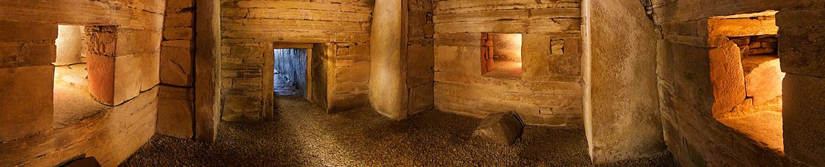
Between its inner and outer wall faces was a core formed by a row of immense boulders, surrounded by smaller rocks and cobbles.
There was also a notable difference between the two wall faces. The outer – the side viewed from outside the complex – saw carefully selected, large, rectangular sandstone blocks used at its base with regular courses of quarried stone above.
In sharp contrast, the inner wall face featured irregularly coursed stone – the building material of random size and, occasionally, irregularly shaped.
Interestingly, it was also markedly different to what we saw with the buildings, where the outer masonry was inferior to that found in the interior.
The role of the ‘Great Wall’

People in the Neolithic seem to have been obsessed with demarcating and enclosing space – the most obvious examples being the ditches, banks, walls and standing stones we see around monuments such as Maeshowe, the Ring of Brodgar and Stones of Stenness.

Boundaries controlled access.
They not only kept people out but, in some cases, perhaps kept “something” in – enclosing and containing an area.
There is no doubt that boundaries were clearly important elements in the Neolithic. But the “Great Wall” took this to a new level.
Why?
Based on the current evidence it seems unlikely that the northern boundary wall was built for defence. For one thing, you do not need to raise a four-metre-wide wall for that.
Instead, it seems the boundary walls – like the buildings they contained – made a highly visual statement.
They not only marked the boundaries of an area of special significance, but separated it from the “outside world”.

The “Great Wall” did this with style.
The imposing construction, with its monumental entrance and ditches, would have dominated the Ness of Brodgar from all directions. Its sheer scale made a stark and conspicuous statement: “This is our place. We can, and have, built this.”
The time and effort that went into the wall’s construction would be clear to all who viewed it, reinforcing the influence, status and power of those involved in the activities beyond it.
As we have seen, the stonework on the northern wall’s outer face was much finer than that of the inner. Although we cannot say for sure, it, perhaps it, like the buildings, was embellished with decorated and coloured stone.
This strongly suggests it was meant to be seen from the north-west and by those outside, or approaching, the complex.
How high?
Viewing the remains of the northern boundary wall there is no doubt it was a monumental construction.
Its width is clear for all to see but was this matched by its height?
The excavated wall sections survive to a height of 0.65 metres, but, obviously, we cannot tell from these how tall it once was. Its sheer width, however, implies it was a construction of considerable height. Why build a four-metre-wide wall if you were not intending to match the width with height?
In addition, compared to its Trench J neighbour, Structure Five, the wall’s basal course was found to be deeply pressed into the underlying glacial clay. This suggests it supported a wall of considerable weight – and probably height.
As we’ll see, the southern boundary wall survived to a height of 1.8 metres, so it seems unlikely the “Great Wall” was any different. But is there any evidence?

Near the wall’s north-western curve, excavation in 2018 revealed a stone, step-like feature tied into the fabric of the inner face.
Trench J was extended again in 2022, fully exposing the area between Structure Five and the wall. This revealed a second set of steps.
Both sets of steps were set into the wall face, leading up in the same direction, and the wall face behind them curved slightly outwards to support now-missing higher steps.
If you are building something that requires steps to scale, or at least see over, it implies a fair height.
The presence of steps also suggests that access to the top of the wall was required – something that might go some way to explain the wall’s width. Was it more than just a boundary but perhaps a highly visible “stage” or platform?
If so, how was it used? Was is involved in the ceremonies or events relating to activity within the Ness complex? Or just another way to highlight the “differences” between those on either side of the wall? We can only speculate.


Defining a ‘no-go’ area?
The “Great Wall” appears to have been more than an imposing barrier to the living.
In 2004, geophysical surveys of the Ness of Brodgar isthmus revealed a distinct lack of archaeological activity in a large area surrounding the Ring of Brodgar. This cut-off was even more pronounced in the 2025 geophysical results.
These showed that building to the south-east of the stone circle stopped abruptly and that an area around it was maintained as a definite “no-go” area – building-wise at least.
North-west of the Ring of Brodgar, the lack of activity continued until the Dyke o’ Sean – another Ness-spanning wall that runs from loch to loch. Beyond it activity resumed, with the surveys confirming a huge concentration of archaeological features, including structures, boundaries and enclosures..

Three years later, in 2007, excavation confirmed that the building cut-off point was defined by the northern boundary wall – the southern limit of an apparently significant area in the Neolithic.
What did this enclosed area of land represent? Why was it apparently inappropriate to occupy or raise structures within? We don’t know. But the fact that it was avoided in prehistory and that its boundaries were clearly defined by a pair of monumental stone walls (and possibly a third) is surely more than coincidence.
We are left with a sense that we are looking at a place separated off from the “everyday” world. An area that was deliberately kept apart – symbolically and physically – from the rest of the landscape.

Applying his theory of domains of the living and dead from Stonehenge/Durrington Walls to the Stenness area in 1998, Professor Mike Parker Pearson pondered whether the area where the lochs of Harray and Stenness meet marked, like the River Avon, a boundary between the domains of the living and the dead.
In a paper presented at the Neolithic Conference in Kirkwall in 1998, Prof Parker Pearson suggested that the Standing Stones of Stenness, with its central hearth and surrounded by evidence of feasting, settlement and activity, represented life and the world of the living.
In stark contrast, the Ring of Brodgar, with its marked lack of domestic activity and surrounded by a complex of Bronze Age burial barrows, represented death or a spiritual domain of the ancestors.
As such, he suggested the procession between the two stone circles could be seen as a symbolic journey from life to death.
Whatever the situation, it does seem that the two walls enclosed a space set apart from “everyday” life and perhaps connected with the stone circle. Or was is simply perceived as being distinctly different and as such avoided?
The outer face
Until 2023, only a small portion of the wall’s outer faced had been exposed, so another trench extension was opened across its width to reveal more.
This highlighted, again, the contrast between the two wall faces – the inner face, which used large boulders and rougher stones, and the outer wall face, which was made up of courses of flagstone slabs, carefully selected and laid.
These had been quarried locally, and not formally dressed, instead utilising the natural bedding planes and fracture lines running through the rock to create the building blocks we see today.
The extension showed, once again, that the wall was meant to look best from the outside…


A line of substantial stones was found embedded in the ground some distance from the base of the wall. These were collapsed masonry that had fallen from a higher section – apparently pushed from the top of the monumental wall during its dismantling.
Their distance from the outer wall face – and the fact they fell long enough to invert – suggests the wall stood at least 1.5 metres high and probably much more.


3d models
- Structure Five and the ‘Great Wall’ (September 2023)
- 2023 excavated section of the ‘Great Wall’ (August 2023)
- 2023: Outer wall face (July 2023)
- Structure Five and the ‘Great Wall’ (August 2022)
- Structure Five (July 2021)
- Trench J (August 2019)
- Trench J – end of season (August 26, 2018)
- Trench J (August 7, 2018)
The southern boundary wall

In 2009, an exploratory trench was inserted over a large, linear geophysical anomaly to the south-east of Trench P.
Trench R confirmed the presence of a second isthmus-spanning wall, but one that was different to its counterpart 125 metres to the north-west.
With a width of two metres, the “Lesser Wall of Brodgar” was much narrower but survived to a height of c1.8 metres.
It exhibited finer masonry and was built using flagstone slabs, rather than large stone blocks, and had been raised on top of the remains of earlier buildings. Its outer face – the side facing the Stones of Stenness – was also paved along its base.


Unlike the northern wall, the geophysics did not show anything that could be interpreted as an entrance. The wall does, however, seem to relate to the two standing stones at its northern end, perhaps suggesting they were part of an entrance feature.
The occurrence of stone pairs at entrances is something we have pondered here.
When were the walls built?
The Ness of Brodgar: As it Stands. (2020)

The northern wall was built on virgin ground – constructed directly on top of natural boulder clay. This, and other archaeological evidence, suggests it was raised early in the site’s history.
But the fact it respects Structure Five, and curved around its northern end, suggests to two are roughly contemporary, dating to around 3300BC.

The southern boundary wall, however, arcs across the Ness, with geophysical survey in 2025 suggesting it was not connected to the “Great Wall”. This, and the fact it was raised on the remains of earlier buildings, suggests the “Lesser Wall” belonged to a later phase of activity.
The time of the “Great Wall” did not last.
By around 3200BC – a century or so after the construction of the piered buildings in Trench P and 300 years before Structure Ten – the wall had been dismantled to its current height. [1]
The southern wall, however, remained standing until the end of the complex’s life.
So why was the “Great Wall” demolished?
Probably because it no longer served as a site boundary and had been replaced.
An exploratory trench over the wall revealed what could be more buildings, and a possible hearth. Together with geophysical scans, this suggest that structures spilled out to the north-west, beyond the original confines of the wall.
In addition, the remnants of another large ditch have been found to the north-west, discovered in section when the shore path along the Loch of Harray was built. Four metres wide and one metre deep, this huge earthwork – like those around the Ring of Brodgar, Stones of Stenness, Maeshowe and Ring of Bookan – seems to have enclosed the buildings we now suspect lay beyond the “Great Wall”.
What this tells us that the boundaries were not fixed but, like the Ness complex itself, changed over time:
Were the boundary walls connected?
For many years we believed that the Ness complex was enclosed, with a pair of connecting walls running between the northern and southern boundary walls. The suggestion of an enclosing wall stemmed from geophysical survey results. But by 2019, doubts were growing due to a lack of excavated evidence.
Notes
- [1] Card, N. and Edmonds, M. (2020) Setting boundaries. In Card, N., Edmonds, M. and Mitchell, A. (eds) The Ness of Brodgar: As it Stands. The Orcadian: Kirkwall.
- [2] Richards, C. (1996) Henges and Water: Towards an elemental understanding of monumentality and landscape in Late Neolithic Britain. In Journal of Material Culture, 1(3), pp.313-336.


