


The Bay of Skaill, in the West Mainland parish of Sandwick, is renowned as the home of Skara Brae.
Although tens of thousands of visitors visit Skara Brae and the adjacent sandy beach annually, only a fraction of these look beyond the World Heritage Site and its visitor centre.
But the incredibly well-preserved remains of the Neolithic settlement at the southern end of the bay are merely the tip of the iceberg in a landscape filled with archaeology.
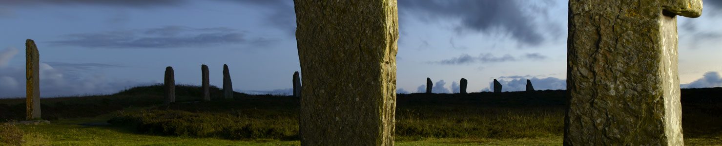
Skara Brae

For this trail, we will begin at Skara Brae and make our way north along the shore.
Access to Skara Brae is ticketed, so anyone planning a visit should make their way to the nearby visitor centre first. At the time of writing visits must be booked in advance.
While viewing the consolidate remains of the 5,000-year-old settlement, take a step back and look around. To the north the area now covered by the sea was once land, meaning Skara Brae sat some way inland.

The structures visible today are not a snapshot in time but show multiple elements from different time periods.
Until very recently Skara Brae was one of only three known Neolithic settlement sites and straitjacketed into a model in which it went through its life as a cluster of no more than ten to twelve houses, inhabited by a population of around 70.
Archaeological work in the past two decades, however, indicates that what we see now is perhaps just a small section of what is probably a more extensive settlement — both spatially and temporally.
As late as 2000, this was dismissed. Although David Clarke, who excavated a section of the site in the 1970s, conceded that archaeological remains seaward of the village were long gone, he stressed that “… archaeologists are fairly confident that landward, little, if anything remains to be discovered”.
We now know this is not the case.
![Geophysics survey result of the Bay of Skaill area, Sandwick. The cluster of anomalies around the consolidated remains of Skara Brae, suggesting additional prehistoric activity, are highlighted in the box. (ORCA/Landscapes Revealed [2019])](https://i0.wp.com/www.nessofbrodgar.co.uk/wp-content/uploads/2021/05/skaill-geophys.jpg?resize=720%2C683&ssl=1)
South of Skara Brae, fieldwalking in 1984 identified a scatter of flint, bone and a stone tool identified as Neolithic. While this alone doesn’t mean we have further settlement, geophysical surveys now strongly suggest that the excavated portion of Skara Brae is but one part of a much larger settlement.
A series of magnetic anomalies to the south and west of the site hint at a settlement that could be as much as five times the size of the visible remains. Of course, this doesn’t mean that all areas were in use at the same time.
We also know that during the lifetime of Skara Brae the area now covered by the sea was a mix of dry land, freshwater lochans and marsh, with encroaching sand and machair. This, together with archaeological remains eroding from the banks along the length of the bay makes a lost northern section very possible, if not probable.
Skaill House

A short distance to the south-east of Skara Brae is the 17th century Skaill House.
Built in 1620, for Bishop George Graham, it has grown to its present size over the centuries.
In Orkney, the name Skaill, from the Old Norse, skáli, usually relates to a high-status site. It may be that Skaill House now sits on this site, or it may have stood somewhere else in the vicinity. Little is known about the early history of the Skaill House site, but human remains have been found on a number of occasions during work in and around the property.
Renovations in 1996, prior to its opening to the public, revealed burials to the east and south of the building. Subsequent excavation found the graves of 12 adults and 15 children, part of a medieval cemetery dating to a period between the mid 11th century AD and the later 14th century. The cemetery was covered by windblown sand at some point in its history and seems to have been forgotten about.
It may, however, be related to a suspected medieval chapel to the east of Skaill House, but the extent of the cemetery remains unknown.
Eroding archaeology

Before heading north along the shore, from the beach beneath Skara Brae make your way westward and your view will be dominated by a massive mound at the south-western end of the bay. It doesn’t take an archaeologist to recognise masonry and wall lines eroding from its exposed face.
The mound, 100 metres to the west of Skara Brae, was investigated in the late 1970s/early 1980s, revealing at least two, if not three, major structural phases, separated by large deposits of windblown sand. While these were not examined beyond basic recording, it was stated “there can be no guarantee that the earlier horizons represented in this mound are not Neolithic”.
In the winter of 1992-93, storms caused substantial damage to the area around the mound.
Between it and Skara Brae, the elements exposed animal remains and stone tools. Red deer formed the bulk of the animal bone assemblage with only a few cattle and sheep bones encountered.
Excavation suggested a butchery site — but one which had been divided into two distinct sections by a stone wall. West of the wall were large quantities of disarticulated animal bone — including five deer jawbones and three antlers — and “Skaill knives”, a cutting tool fashioned from split beach cobbles.
On the eastern side of the wall, Skaill knives were less numerous and the animal remains were articulated, including a complete skull with attached antlers. The excavated remains were part of a more extensive deposit that continued into the sand dunes.
The excavation was invaluable to our interpretation of life at Skara Brae and Neolithic settlements across Orkney. Not only did it suggest that the processing of animal carcasses took place away from dwelling areas but that there was an “overwhelming predominance of deer at Skaill Bay compared to other Neolithic and Bronze Age sites”.
To the excavators, the Skaill site was a specialist deposit predominantly, but not exclusively, dedicated to deer processing. Many of the remains were originally articulated and at least two adult red deer and a juvenile were brought to the site whole. They seemed to have been deposited but not fully exploited for venison, skins or antlers – a fact that suggests deer were treated differently in the Neolithic.

Later burials
In the 1990s, a cist eroding from the mound was excavated and found to contain the remains of a young male who had been buried in the mid 6th to late 7th century AD. The cist was close to the site of a viking burial, found in 1888, and which was found to contain a male skeleton and grave goods. Based on the contents, the burial is thought to date from the 9th century AD.
Above Skara Brae itself, in the vicinity of House Seven, the excavation and consolidation of the site revealed two later cist burials. The dates of these inhumations remains uncertain.
Coastal erosion

Making your way north along the beach, keep an eye on the banks above the shore to your right.
Aside from Skara Brae, the Bay of Skaill is equally renowned for the coastal erosion that plagues it.
Talk of coastal erosion and people often think in timescales of centuries. At Skaill, however, it can often be measured in days, weeks and months. Perhaps the starkest, most visual example of this is the complete destruction — over 20 or so years — of a modern, stone-built and enclosed, picnic area that once sat above the beach.
The effect on archaeology is even more severe with fragile remains exposed and damaged daily. Walking along length of the bay you will see archaeology dropping onto the beach – particularly around the southern and northern ends.
Bronze Age cemetery
About half-way along the beach, beside the car park, climb up on to the bank and look east. Directly ahead you will see the low ridge of the hill Sandfiold (not shown on the above map).
An area west of Sandfiold has long been known for the presence of burial cists. Dozens, if not more, were recorded in a map of the area in 1772.

At this time two of the mounds were opened by Rev George Low. His excavation party included the celebrated naturalist Joseph Banks, later President of the Royal Society, who was taking a tour of Iceland and the Scottish isles after losing his place on James Cook’s expedition on HMS Resolution.
From the antiquarian’s description of the remains and the style of burial, the Sandfiold mounds were suspected to represent a Bronze Age barrow cemetery. The discovery and excavation of “an exceptional cist” in the area in 1989, together with another in early 2021, which contained a remarkably preserved, articulated skeleton, confirmed this interpretation.
The Castle of Snusgar
From the higher ground by the road, you will see a series of larger mounds to the north. One of these goes by the name of the Castle of Snusgar.
This mound, and another to its east, were excavated between 2005 and 2009, each revealing the remains of a Norse longhouse, dating from the 10th and 11th centuries AD.

Much ink has been spilled regarding the Castle of Snusgar over the years, in particular the idea that the placename must mean there was once a substantial fortification in the vicinity. As we will see later, that is not necessarily the case.
The earliest record of the name dates to 1795, when Rev William Clouston wrote in the Old Statistical Account of Scotland:
The excavations mentioned above, however, showed no evidence of any large structure having once stood on top of the mound.

Writing in the second half of the 18th century, Sandwick man George Marwick recorded a folk tale that attempted to explain the presence of the mound and the apparent ruins that were “(it is said) still to be seen here.”
According to Marwick’s tale, the Snusgar mound represented the funeral pyre of the preternatural “fin-king”.
The fin-king’s body reduced to ashes, a:

Obviously, we cannot rely on the fin-king myth, which, as Tom Muir has pointed out, shares many elements with a story collected in the Lofoten Islands, Northern Norway, in the 1870s.
But what the folktale can tell us is that stone features of some kind were visible on and around the mound, presumably for quite some time. So prominent, in fact, that a folktale grew up around them to explain their presence.
Although it seems Marwick wasn’t sure whether stone features remained visible at the end of the 19th century, by 1923, in his account The Antiquities of Sandwick Parish, John Fraser was clear that “nothing now remains to indicate what sort of building it was”.
Fraser was of the opinion the Castle of Snusgar mound contained a broch – an interpretation held by many until the end of the 20th century. This is not an uncommon assumption surrounding large mounds in Orkney, particularly where stonework is visible. Remember that before the 2013 excavation, the mound at the top of Trench T at the Ness of Brodgar had long been held to be a broch.

The situation regarding Snusgar was complicated by the placename, in particular the belief that “castle” had to represent just that. However, before we get too preoccupied in looking for ancient fortifications, there is one important fact that needs to be stressed.
Derived from the Old Norse “kastali”, a reference to a “castle” in an Orkney placename does not automatically refer to a structure. Instead it is a reasonably common element in coastal topography, usually referring to large rocks. In 1999, Dr Sarah Jane Gibbon recorded 104 castle/tower placenames in Orkney, of which 38 referred to coastal features.

On the western coast of Sandwick we can find another two “castles” – the sea stacks known as the Yesnaby Castle, or more correctly the Castle of Quoyayre, and further south, the North Gaulton Castle.
Closer to Snusgar, there are more.
According to Hugh Marwick’s Orkney Farm Names, a mound near the farm of Linahow, directly north of the Bay of Skaill, is, or at least was, also known as “The Castle”. In addition, an 1834 map of the area not only shows the “Castle of Snousgar” (sic) but a little way to the east is the “Castle of Sandfiold”.
It seems that, in this area of Sandwick at least, “castle” was being applied to large mounds – probably suspected broch sites.
The Snusgar name itself is interesting but doesn’t tell us much.
The first element seems to derive from the Old Norse snös meaning “protruding rock” – which could be argued to apply to the “remains” once visible on the mound.
Alternately, and perhaps more likely, it could refer to the rocky skerries on the north side of the Bay of Skaill, directly opposite. A similar rocky area in Birsay is known as Snus(h)an – literally “the protruding rock”.

The Skaill hoard
In March 1858, a Sandwick lad found some pieces of silver lying near a rabbit hole. This led to the discovery of one of the largest Viking treasure troves found in Scotland.
The location of the find is not clear, with George Petrie’s official report at the time stating only that it was:
In 1874, writing in the Proceedings of the Society of Antiquaries of Scotland, Joseph Anderson states it was found:
The 1902 Ordnance Survey map of the bay places the find spot a short distance east-north-east of the Castle of Snusgar.
Weighing in at 16lbs, the silver hoard was made up of over 100 artefacts, including Anglo-Saxon and Arabic coins, nine brooches, 14 necklets, 27 armlets and an assortment of ingots and silver fragments.
Based on the coins, the hoard is thought to date to around AD950-970.
Burials, walls and midden

Around 200 metres to the north-west of the Castle of Snusgar, close to St Peter’s Kirk, is another large mound sitting directly above the shore.
Roadwork in 1934/35 revealed walling in the area of the mound, along with midden material indicative of occupation. Among the “old bones” was a bone pin, “similar to one found at Skara Brae” and an unknown quantity of boar tusks.
It also revealed the skeletons of four individuals, but details are sketchy so all we really know is that the “unenclosed” remains were under ten feet of sand and a double layer of “midden deposit”.
The fact one body had been laid in a crouched position suggests a Bronze Age date, but, unfortunately, there were no artefacts that could help date the burials.

Were these inhumations inserted into the sand-covered remains of an earlier, abandoned settlement? Or, as at Toftsness, in Sanday, and the Links of Noltland in Westray, did occupation on the site of a Neolithic settlement continue into the Bronze Age?
The answer to those questions cannot be answered without excavation.
The human remains were re-buried between the mound and the beach, the place marked by a stone slab carved with a cross. The burial site and stone can still be seen today, although it is now perilously close to the eroding bank of the beach.
Back on the shore, archaeology is eroding from the banks directly below this mound and for some way to the south. It was in this area that a large, probably Neolithic, incised stone was found in January 2021.
Knowe of Verron

At the north end of the bay, a path above the rocky skerry, leads walkers to the west – although sections of this path have collapsed and are impassable due to erosion.
Following the surviving section around the headland will bring you to the Knowe of Verron, a suspected Iron Age broch site perched high on the clifftops.
The site is completely covered in thick grass with few masonry features visible.
If you are planning a visit to Verron, please be aware of the precipitous drops and don’t stray too close to the edge. Although an area might look solid, the action of the elements eats away at the rocks.


