
The Norse on the Ness
By Sigurd Towrie
A few weeks ago conversation at excavation HQ drifted from matters Ness and the Neolithic to apparent Viking Age runes found in the 1920s at the nearby Brodgar farm.
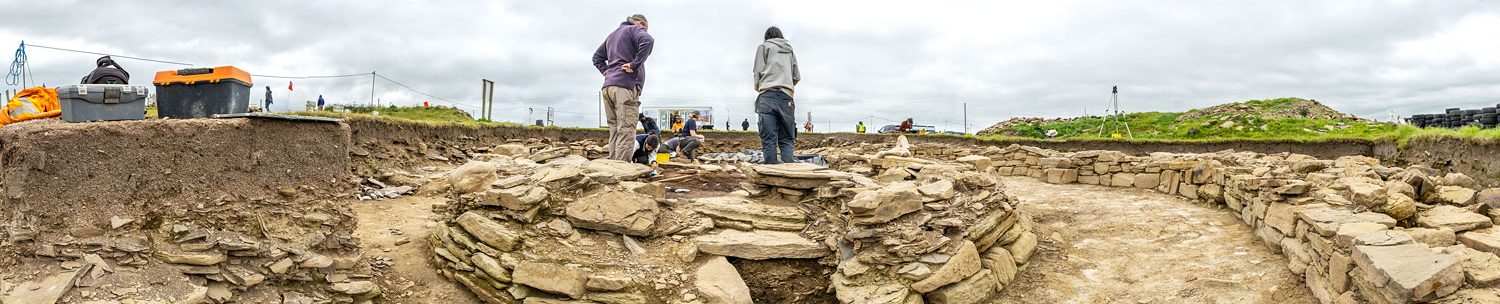
The farm lies a few hundred metres north-west of the excavation site where, in 2007, a fragment of a Norse whetstone was found in topsoil while opening Trench P.


The stone tool, used to sharpen metal blades, post-dated the Neolithic complex by 4,000 years, give or take a century or two. A lack of Norse/Viking Age structural archaeology in the immediate area suggests the whetstone must have been dropped or discarded.
The artefact was examined by our lithics specialist Anne Clark, who described it as a haunched hone stone, made of schist, and akin to those found in the Norse layers of the Pool multi-period settlement site [1] in Sanday, one of Orkney’s North Isles.
The Pool whetstones dated from between AD950 to around AD1220, a time when Orkney was part of Norway – a situation that changed in 1468, when the archipelago was handed to Scotland as part of a wedding dowry.
The Norse began colonising Orkney in the eighth or ninth century AD and before long the islands became a vital link in their western sea-routes.
Exactly how the Norse takeover took place remains a hotly debated subject to this day. Was it a peaceful integration? Or did the “invaders” wipe out their predecessors?
Whatever the circumstances, by the end of the ninth century Orkney’s culture and way of life was that of a Norse earldom – an earldom that became a powerful political unit and had considerable impact on the history of Scotland.
Evidence of this period is everywhere – not just archaeological remains but in the culture, traditions and, in particular, placenames.
The Ness of Brodgar, for example, derives from the Old Norse nes (meaning headland; point of land), brúar (bridge) and garðr (farm). The parish of Stenness itself is steinn and nes – the headland of the stones. And there are placenames of Norse origin all around the Ness.
So although we’ve got plenty of toponymical evidence, what about the archaeology?
Aside from Brodgar farm there is surprisingly little evidence of Norse activity on the Ness itself.
The present Brodgar farm buildings are much later, but we know that the farm appears in records in 1507, and probably existed at least half-a-century earlier. In 1449, Magnus Brogar was an Orcadian mercenary fighting in France [2].
His surname tells us that the farm, and by extension the Brig o’ Brodgar, was in existence by the middle of the 15th century.
Further to the north-west is another farm placename – Wasbister.
Usually interpreted as “west farm”, there’s a problem because we don’t have the remains of anything relating to a possible medieval farm. With this in mind, Gregor Lamb has suggested the name is a corruption of Vaðs-bólstaðr – meaning ford farm – and that Wasbister was the original name for Brodgar before the construction of the bridge. [2]
A Viking Age presence to the north-west, near Bockan Farm, could be indicated by the discovery of a steatite vessel fragment. [3]
The nearest source of steatite – also known as soapstone – is Shetland. Although it use was common in the Norse period, we know it was imported into Orkney from the Early Bronze Age.
A 19th century antiquarian “excavation” of the tumulus now known as Plumcake Mound, near the Ring of Brodgar, revealed a burial cist containing a steatite “urn” containing cremated bone.
Steatite’s association with Viking Age assemblages led to the assumption that the mound, and others around the stone circle, was the burial place of a viking warrior. This antiquarian interpretation seemed to be borne out by a saga account of a battle in the area in the 10th century:
I have dealt with this placename elsewhere and mention the account here simply to show that an area of Stenness was associated with a Norse battle from as early as the 13th century.
This fuelled the belief that the mounds around the Ring of Brodgar were “the tombs of the early Scandinavians”. [4]
We now know this is definitely not the case.
Once regarded as undisputed proof of Viking Age activity on the Ness, the validity of a series of runic inscriptions [5] is also now looking less certain.

Carved into the stump of one of the Ring of Brodgar megaliths is a group of twig runes – so called because of their twig-like appearance – above a cross. The inscription was found in 1907, during an operation to erect the fallen stone. When it was lifted, the incised runes were found on the side that had been lying on the ground.

Michael Barnes, Professor Emeritus in the Department of Scandinavian Studies at University College London, has shown the normal method of decrypting twig runes yields nothing – either NROUN or possibly NUON, neither of which are Norse words. [6]
Shortly after their discovery, however, Magnus Olson read the runes from right to left. This, and ignoring a faint “branch” on the furthest right rune, led him to declare the runes represented “biorn” and therefore the personal name “Bjorn”. [5]
Barnes, however, has questioned Olsen’s “Bjorn” translation.
Even if we accepted the assumptions about the inscription, he wrote that there is still a problem with the second rune – the non-twig rune representing “u”, or possibly “r”, faces the wrong way.

In addition, although two of the runes were badly weathered, the other three, and the cross, were remarkably clear. Comparing them to the known Victorian graffiti within the Ring of Brodgar, Barnes concluded that “the four latter symbols, at least, cannot have been exposed to wind and weather for any length of time.
“If they are medieval in origin they must either have been covered up soon after they were carved, or have been re-cut in modern times.” [6]
A second runic inscription was found at the stone circle in 1908, but has since been lost. It appeared on a loose stone in the south-western section of the ring and featured a single twig rune cut above a carved cross. Fortunately the find was documented before the stone disappeared.
Once again Olsen suggested the rune represented a personal name – the initial of a name such as “Olaf” – echoing his “Bjorn” interpretation for the runes cut into the nearby megalith.
Barnes, however, pointed out that: “Few inscriptions consisting of a single twig-rune are to be found in Scandinavia, and the one or two that do exist seem to be copies by unpractised hands”
He noted that the now-lost carving was simply a mirror image of the second twig rune on the “Bjorn” inscription – even incorporating the cross underneath. Was it, he suggested, merely a later copy scratched into a stone by a visitor to the Ring of Brodgar? A copy that was later discarded?
As Barnes put it “imitation is possibly the key…”
In the 1920s a third example came from Brodgar farm. In this case, three twig runes had been carved into a stone incorporated into a field wall on the farm. Yet again to Barnes the markings made “little sense, however read, and are most reasonably interpreted as the product of an unskilled doodler.”
He added: “Whether such a person is to be viewed as medieval or modem is impossible to decide given the almost total lack of pointers.”

Two further inscriptions have been found in the vicinity of the Stenness loch, but outwith the Ness of Brodgar – a block with two twig runes on the southern shore and a steatite disc claimed to be from the remains of the Stackrue broch, near Lyking, to the north. The latter featured plain and twig runes but the meaning of the inscription is again not clear.
Olsen regarded the stone as “an amulet, ‘magically’ inscribed…”
Prof Barnes was not so sure:
“Stackrue is [an object] of uncertain provenance incised with eight runes or rune-like symbols, plain and twig, bearing no obvious message. While clearly this is not of itself evidence of modern origin, there is perhaps enough to arouse suspicion.
“The twig-runes that in another context might argue for authenticity provoke added doubt because of their startling frequency in Orkney. If the carving is indeed medieval, we must at least concede it was made by someone unskilled in writing runes. Possibly that is why its purpose is unclear – if it ever had a clear purpose in the first place.”
As for the stone block, Barnes was clear: “If these were ever intended as twig-runes, they were carved by an incompetent.
“This inscription may for all I know be medieval…but it can hardly be classed as runic.”
So, as we’ve seen there is some doubt that the runes on and around the Ness are genuine. It is simply not possible to confirm whether they are genuine and not later “graffiti” – perhaps people copying the runes exposed after the excavation of Maeshowe in 1861.
The name “Ingibjorg” is carved in runes on Maeshowe’s inner chamber wall. There its authenticity is without doubt, but the same name is also found, in medieval Scandinavian runes, on another of the Ring of Brodgar megaliths and also inside the Neolithic Cuween chambered cairn in the parish of Firth.
As we have seen previously, Cuween was filled with rubble until excavated, making it highly unlikely that a wandering runecarver could have gained access before the 19th century.
Writing in 2003, Prof Barnes concluded: “Since no one seems to have noticed either inscription until a few years ago, and a postcard [from Maeshowe] widely available in Orkney features the name in almost identical form…it is safe to conclude these are modern copies.”

A fourth dubious inscription exists on a side-chamber lintel inside the Knowe of Unstan.
Again, it cannot be translated but this is perhaps unsurprising when we consider that the 19th century excavators made no mention of these deeply cut runes. They must have have been carved between 1884 and 1934 – that is between excavation and restoration.
But although it seems we can discount most, if not all, the Brodgar runes as evidence of Norse activity, there’s little doubt that the Ness was in use throughout the period. Its name, for example, fixes it firmly to the farm of Brodgar and as late as the 19th century the boggy nature of sections meant it was perhaps unsuitable for other use.
A recent project has suggested that the Stenness and Harray lochs were an integral part of a Norse waterway connecting Scapa Flow to the Brough of Birsay [7]. It proposes that vessels entered the Stenness loch at the Brig o’ Waithe and from there entered the Loch of Harray via the shallow water at the Brig o’ Brodgar.
Writing in 1851, Lieutenant Thomas explained that: “Until lately stepping stones enabled the foot passenger to cross the ford dry-shod; but a sort of bridge-causeway now supplies a less adventurous mode of transit: this is the Bridge of Brogar.” [4]
While this proposed waterway would have seen shallow-drafted ships pass to its south-east, it is highly likely that the Ness itself retained its prehistoric role as a routeway throughout the Viking Age and beyond.
Until the late 19th century, the track between the parishes of Sandwick and Stenness ran the length of the Ness of Brodgar and it remained in use until the construction of the present road.
It was perhaps on one such journey between the lochs that a traveller discarded their broken whetstone…
Notes
- [1] Hunter, J. (2007) Investigations in Sanday, Orkney: Excavations at Pool, Sanday: a multi-period settlement from Neolithic to late Norse times (Vol. 1). The Orcadian Limited.
- [2] Lamb, G. (2004). Two Orkney Fords. In Lamb, G. (2004) Orcadiana: Pen portraits of the past. Kirkwall: Bellavista Publications.
- [3] Brend, A., Card, N., Downes, J. and Edmonds, M (eds) (2020) Landscapes Revealed: Geophysical Survey in Heart of Neolithic Orkney World Heritage Area. Oxford: Windgather/Oxbow Press.
- [4] Thomas, F.W.L. (1851) Account of some of the Celtic Antiquities of Orkney, including the Stones of Stenness, Tumuli, Picts-houses, &c., with Plans, by FWL Thomas, RN, Corr. Mem. SA Scot., Lieutenant Commanding HM Surveying Vessel Woodlark. Archaeologia, 34(1), pp.88-136.
- [5] Olsen, M. B. (1954) Runic inscriptions in Great Britain, Ireland and the Isle of Man. In Curle, A.O., Olsen, M.B. and Shetelig, H. (1954) Viking Antiquities in Great Britain and Ireland.
- [6] Barnes, M.P. (2003) Runic tradition in Orkney: From Orphir to the Belsair Guest House. In Waugh, D. J. (ed). (2003) The Faces of Orkney: Stones, Skalds and Saints.
- [7] Richard Bates, C., Bates, M.R., Crawford, B., Sanmark, A. and Whittaker, J. (2020) The Norse Waterways of West Mainland Orkney, Scotland. Journal of wetland archaeology, pp.1-18.


