
Big Howe – an Iron Age broch beside the Stones of Stenness?

By Sigurd Towrie

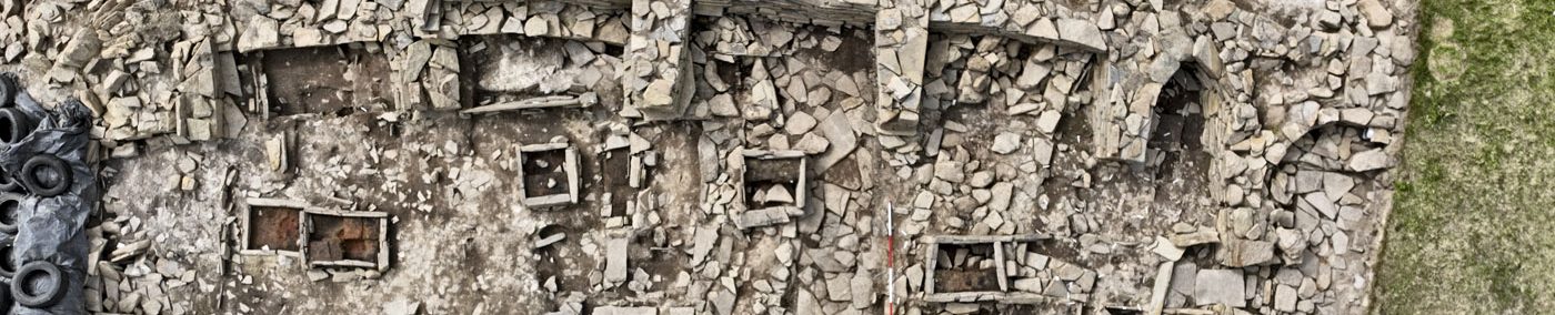
Stand at the centre of the Stones of Stenness today and a short distance to the south-east, in the adjacent field, you will see a low mound. This is Big Howe – all that remains of a large Iron Age feature that once dominated an area 150 metres away from the stone circle.
Big Howe today is a shadow of its former self after being levelled at the start of the 20th century. [1]
Writing in 1923, the Orcadian antiquary James Cursiter stated that the “prominent mound” had been flattened 20 years previously, at which time “it was found to be a broch”. [2]
The mound appears on a 1772 map of the area, in which it is shown as a large, rectangular feature – a depiction described as “a prominent and probably rather fancifully rectangular arrangement of features”. [1]

However, 76 years later, although Lieutenant Thomas showed a sub-rectangular enclosure on Big Howe, it only merited the short comment that introduced this article. [3]
Thomas’ illustration is interesting however – it shows a gap to the north-west.

For decades we had no idea what Big Howe represented, other than the assumption that Cursiter was correct and it was a broch.
Then, in 2002, a project to geophysically scan the Heart of Neolithic Orkney World Heritage Site – a ten-year project that surveyed a 285-hectare area between Skara Brae and Maeshowe.

The results were remarkable, revealing a large “lightbulb-shaped” enclosure (c60m by 75m) surrounded by a five-metre-wide ditch and with an entrance to the north-west. [1]
We don’t know how much, if any, of this was still visible to Lieutenant Thomas in 1848, but it is interesting that he clearly shows what appears to be an entrance feature in the same area as the geophysics.
Big Howe appears to have had an elaborate entrance, with the boundaries projecting north-west before turning towards each other to leave a narrow opening. Inside the ditch was a large oval feature too big to represent a broch.
Measuring 40m by 44m, it may be that this represents the outer edge of the settlement between the centrally placed broch and the outer enclosure – a pattern noted at broch sites across Orkney. Adding weight to this theory are the dense geophysical anomalies indicative of settlement activity. [1]
A circular anomaly, c25 metres in diameter, inside the enclosure could represent the broch itself. [1]

The presence of a broch settlement 150 metres away from the Stones of Stenness is interesting and ties in with archaeological evidence showing Iron Age activity within the stone circle.
The 1906 operation to re-erect the fallen megaliths within the Stones of Stenness produced 51 sherds of Iron Age pottery, the style of which places them between 50BC to AD300. [4]
In addition, one of five pits discovered during the 1973/74 excavations, to the south of the monument’s central hearth, produced a piece of charcoal that was radiocarbon dated to between AD 250 and AD900. [5]
This pit is thought to be contemporary to the others, due to the pottery and a stone tool found in those.
Clearly the Stones of Stenness had remained a focus of attention in the Iron Age.
It may be that the putative Big Howe broch and settlement were, like sites throughout Orkney, built on top of earlier Bronze Age and Neolithic remains, for example Howe, in Stromness.

To the south and south-west of Big Howe are the sites of potential Neolithic settlement.
With Barnhouse to the north-west, it would not be unreasonable to suppose there is earlier activity at Big Howe, particularly when the geophysical surveys revealed areas of enhanced soil that could pre-date the suspected broch. Further evidence comes from 19th century finds in the vicinity – a carved stone ball and flint artefacts.
As we have seen at Quanterness, the Iron Age appropriation of earlier sites created a tangible link to the past.
The first age of monument building in Orkney ended with the Neolithic.
With Big Howe, the construction of a broch in the vicinity of an already ancient, prominent prehistoric site takes on a special significance when we consider that the Iron Age was the time when monument building resumed – in the form of brochs – and paralleled the Neolithic in terms of quantity and geographical spread.
Before we sign off on Big Howe, it should be stressed that the presence of a broch is a hypothesis based on the results of geophysical scans of the area.Prior to the Ness of Brodgar excavations, the Trench T mound, known as Koknacumming, had long been thought to contain a broch…
Notes
- [1] Brend, A., Card, N., Downes, J., Edmonds, M. and Moore, J. (2020) Landscapes Revealed: Geophysical Survey in the Heart of Neolithic Orkney World Heritage Area 2002-2011. Oxbow Books, Oxford
- [2] Cursiter, J. (1923) The Orkney Brochs. Proceedings of the Orkney Antiquarian Society. Vol 1.
- [3] Thomas, F.W.L. (1851) Account of some of the Celtic Antiquities of Orkney, including the Stones of Stenness, Tumuli, Picts-houses, &c., with Plans, by FWL Thomas, RN, Corr. Mem. SA Scot., Lieutenant Commanding HM Surveying Vessel Woodlark. Archaeologia, 34(1).
- [4] Ritchie, J.N.G. and Marwick, E.W. (1975) The Stones of Stenness, Orkney. In Proceedings of the Society of Antiquaries of Scotland (Vol. 107, pp. 1-60).
- [5] Canmore Radiocarbon Database. https://canmore.org.uk/c14index/2105


