
The Stone of Odin

By Sigurd Towrie

Our excursion around the Ness of Brodgar now focuses on a monument that is no longer there. But considering the Stone of Odin’s significant role in Orcadian life, we cannot ignore it.
Until the winter of 1814, the holed monolith stood to the north-west of the Stones of Stenness. But although its special place in the customs, traditions and folklore of the people of Orkney is well documented, details of the stone itself remain frustratingly unclear.
The early accounts of the Odin Stone present contradictory information on the monolith, as do the few surviving illustrations.
It is generally accepted that the stone was approximately 2.5 metres high and just under a metre wide – placing it, in terms of size, somewhere between the Comet Stone and Barnhouse Stone.
It was perforated by a hole beside its western edge about 0.9 metres from the ground. But as we will see the accounts also differ as to its size.
This perforation was “almost certainly [not] a natural feature” and its creation probably “marked this stone as distinct”. [1]
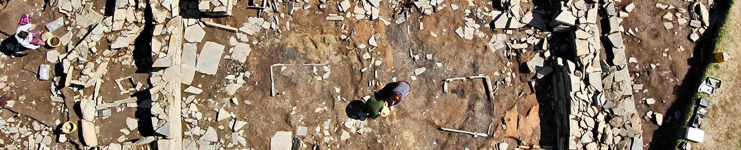
This comment, however, predates the discovery of the Ness of Brodgar and we now know that at least one of the two megaliths flanking Structure Ten‘s entrance was also holed – although, as the photograph shows, its perforation is much smaller than that of the Odin Stone.
Early accounts

Strangely, the author Jo Ben, who wrote the earliest surviving account of Orkney in the 16th century [2b] made no mention of the Odin Stone. That said, although his Descriptio Insularum Orchadiarum does refer to the Ring of Brodgar, it makes no mention of the Stones of Stenness either.
So for one of the earliest descriptions, we must look to the Rev James Wallace [3], who, in 1693, explained that:
As you will see, Wallace did not name the stone.
A few years later, in 1700, Rev John Brand visited Stenness. Brand, a church minister from Scotland, was in the county as part of a “commission appointed by the General Assembly of his Church to inquire into the state of religion and morals in these parts”.
His account is so similar to Wallace’s that one wonders whether it was simply copied:
Then, in July 1760, Richard Pococke, Bishop of Ossory, wrote:
Anyone familiar with the area will immediately notice that Pococke’s sense of direction was somewhat lacking. The Watchstone lies to the north-west of the Stones of Stenness and we now know the Stone of Odin was around 76 metres its south-east, approximately 60 metres to the north of the stone circle.
Fortunately, however, Pococke made the earliest known illustration of the Odin Stone (pictured above). The artwork, although crude, shows a view from the northern end of the Brig o’ Brodgar – but also introduces a mystery.
The Stones of Stenness are clearly visible, as is the Watchstone. But Pococke shows two apparently holed megaliths.
Based on its location, the round-topped megalith between the stone circle and the Watchstone must be the Odin Stone, which begs the question what is the slab-like stone apparently close to the Harray loch? Because it is not mentioned in any other accounts of the time, is this artistic licence or did Pococke make a mistake?

Another depiction of the Odin Stone came after Sir Joseph Banks’ 1772 excursion to the islands. In this case, however, the Stones of Stenness were the focus of John Clevely’s attention and the Stone of Odin appears in the background of his illustration (above).

The 1772 Walden map of the area does show a position for the Odin Stone, which it declares was the “Stone of Sacrifice” [5]. But it is in the map’s ornately illustrated title (pictured right) that we get a clear glimpse of the monolith’s form.
The drawing shows that the stone’s perforation was clearly offset to the western side of the standing stone and also appears to show a worn area between the hole and the edge of the monolith.
In 1780, a naval surgeon, Lieutenant Ker, visited Stenness in the company of a Kirkwall doctor, Dr Groat.
In his diary Ker noted that the Odin Stone, was:
In 1789, another visitor, John Thomas Stanley, produced a fine drawing of the megalith, which he recorded as being 2.4 metres tall, 1.1 metre wide and with the hole 90 centimetres from the ground.

Stanley’s illustration (right), although very similar to the Walden map version, showed a more rectangular profile with the perforation more central to the stone than near its edge.
One of Stanley’s companions stated that the hole was “would admit a hand” but a 1795 account by the minister of Firth and Stenness repeated that it was large enough for a man’s head. [2]
This account also confirmed that the hole and the edge of the stone had the appearance of being worn – tying in with Walden’s 1772 illustration.
In 1805, the Orkney minister Rev George Barry did not name the stone but highlighted the worn edge of the perforation:
“In one of the latter is a round hole, not in the middle, but towards one of the edges, much worn as if by the friction of a rope or chain, by which some animal had been bound.” [5b]
The worn area was undoubtedly behind the claims that sacrificial victims were once bound to the stone. In a drawing of the area presented to the Society of Antiquarians of Scotland in 1784, Rev Robert Henry showed two people beside the Odin Stone and described it as:
The megalith, he wrote, had a:

Unfortunately, Henry’s drawing also gets the location of the Odin Stone completely wrong, stating that it stood “about 100 yards” to the north-east of the Stones of Stenness. The illustration, however, shows two people apparently joining hands through the perforation – an act that relates to one of its major roles in Orcadian tradition…
The Stone of Odin was a place where binding oaths were sworn.
The Odin Oath

As can be gathered from the reaction to its destruction, the people of Orkney believed that the potency of the Odin Stone was unparalleled. Of all the powers attributed to it, the megalith was best-known for its role in sealing agreements and binding marriages.
Orcadians would trek out to the Stenness monolith to make their vows absolute by clasping hands through the hole and swearing the Odin Oath. This was an utterly unbreakable pact, the words to which are now unfortunately lost.
But although the words may be gone, the extremes people would go to before breaking their vows are well documented.
Returning to Ker’s 1780 visit with Dr Groat, from Kirkwall, he wrote:
A few year later, in Rev Robert Henry’s 1784 account, we learn:
Another case, recorded in 1781, involved a young man who had seduced a girl under promise of marriage. The girl, who fell pregnant, was subsequently deserted:

A fine example of just how binding the Odin Oath was considered to be appears in the folklore surrounding the Orkney pirate, John Gow.
While Gow was in Stromness, he supposedly fell in love with a Miss Gordon, the daughter of a local merchant.
Keeping with Orcadian tradition, Miss Gordon took Gow to the Odin Stone, where they pledged their troth. A few months later, however, Gow was captured off Eday, and subsequently executed in London.
Distraught at the death of her lover, Miss Gordon is said to have travelled to London in order to touch the hand of Gow’s corpse to release herself from their binding oath.
This, however, is slightly different to the procedure was documented by Rev Henry in 1784. [2]
Magical traditions

When visiting the Odin Stone, it was customary to leave offerings of food, or ale, and it was common for young people to stick their heads through the hole to acquire immunity from certain diseases.
Along the same lines, newborn infants were passed through the hole in the belief that this would ensure them a healthy future. Crippled limbs were also passed through in the hope of a supernatural cure:
The stone’s healing powers were often combined with the water of the nearby well at Bigswell.
There, the afflicted would circle the well three times sunwise (clockwise) before drinking the water and heading off to the Odin Stone. Children were also bathed in the well before they too were taken to the holed monolith.
In addition, the Odin Stone also seems to have had the power to bestow some of its magic on mortals. One surviving folktale tells how a farmer from the parish of Evie:
Later in the tale, the farmer’s wish is granted and he drives the Finfolk from their invisible island, claiming it and renaming it Eynhallow – Holy Island.
The Odin Stone’s destruction
Although its companion was removed in prehistory, the Odin Stone stood for millennia. Then, one day in December 1814, it was destroyed.
As part of his plan to remove the standing stones from his land, the tenant farmer, Captain W. MacKay, toppled the holed monolith before turning his attention to the Stones of Stenness – an act that did nothing to improve his reputation locally. By the time he was stopped, MacKay had removed one of the Stones of Stenness and obliterated a second.
The December date of its destruction is interesting, given the account written by Rev Robert Henry in the late 18th century:
Henry’s ambiguous text implies the rites to be carried out at the Odin Stone and the two stone circles.also took place around New Year’s Day. However, although he had no doubt that the custom of gathering at the kirk had entirely died out by 1784, I would argue that the traditions surrounding the stones had not.
If they were part of a New Year custom, it goes some way to explain why the standing stones were targeted in December. According to the Orcadian historian Ernest Marwick, one of the reasons MacKay gave for his actions was that his pasture was being ruined by visitors to the stones:
Rediscovering the site
The monolith’s exact location remained unclear until 1993, when geophysical surveys around the Barnhouse Settlement and Stones of Stenness revealed three standing stone sockets, around 60 metres to the north-north-west of the stone circle’s entrance.

Excavation showed the long axis of all three sockets were aligned north-west/south-east. [1]
Expecting to find a single socket for the Odin Stone, the presence of three came as something of a surprise to the archaeologists. What their excavation confirmed was that, in prehistory, the Stone of Odin did not stand alone.
The Odin Stone’s socket, the southernmost of the three, was 0.6 metres deep, with the packing stones still in place. Based on their condition, it was clear the stone had been removed sideways. In addition, the fact the stone packing sloped into the socket ends suggested the megalith tapered towards its base [1] – corroborating some of the early illustrations.
A mere 30 centimetres to the north-west was another socket – one that had contained a standing stone removed in antiquity – either the Late Neolithic or Early Bronze Age. [1]

At some point after this megalith’s removal a fire was kindled in the socket – but how long after is not known.
The presence of a suspected post-hole at the base of this socket also suggests this megalith was preceded by a timber post. Although this could simply represent a marker for positioning the stone, the depth of the post-hole led the excavators to suggest that the timber feature was “something more permanent and enduring”. [1]
The northernmost socket was around seven metres to the north-north-west of the Odin Stone and 75 centimetres deep.
The impression at its base suggested that the stone it held, which was c1.15 metres wide and 0.22 metres thick, had been inserted upside down, with the angled, sloping end – typical of the Stenness and Brodgar megaliths – downwards.
This deliberate act may have meant this inverted standing stone had a flat top. [1]
Stone pairs
Confirmation that the Odin Stone was one of a pair fits the pattern noted with other megaliths in the vicinity.

Based on current archaeological evidence, it seems that pairs (or groups) of standing stones may have been the order of the day – much like the two visible outside Ness dig HQ, a short distance to the south-east of the site entrance.
Not only did the Odin Stone have a twin, but the Watchstone was also one of a pair.
These stone pairs have been likened to the door jambs of Late Neolithic structures and therefore may have represented symbolic doorways – perhaps marking, or controlling, movement through the landscape and the monuments.
Something similar has been proposed for the multiple “standing stone” pairs found within Orkney’s stalled cairns. Projecting from the inner walls, these not only divided the chambers into distinct compartments, but may have defined a path of “doorways” leading to the end cells. [1b]
At the Ness of Brodgar site, Structure Twelve had a pair of standing stones flanking its eastern entrance, while the pair of standing stones outside dig HQ may have formed part of an the Neolithic complex’s south-eastern entrance arrangement.

Excavation of the southern boundary wall – one of the two monumental walls that bounded the complex – revealed that at its north-eastern end it stopped abruptly. It is perhaps no coincidence that the two Lochview standing stones are just over ten metres to the north of the wall.
Did they form part of a south-eastern entrance to the complex?
Unfortunately, the area around the two megaliths was badly disturbed in modern times, meaning further geophysical survey cannot help answer that question.

The fate of the stone

Although local tradition maintained that the fragments of the Odin Stone were used for building material, in the 1950s, Orcadian antiquarian Ernest Marwick found no evidence that this was the case. [2]
However, he did discover that the holed segment of the stone survived until the 1940s, before it too was completely destroyed. Marwick learned that this section had been used as an anchor for a horse-powered mill-shaft that moved around the parish as the mill changed hands.
In the early 1940s, when it was finally decided to replace the horse-drawn mill with an engine-driven threshing machine, the remains of the old mill, including the Odin Stone fragment, lay around gathering moss.
Then, the day came that the owner’s son decided to tidy up and remove the old machinery. Unable to move the stone fragment, and ignorant of its history, he reduced it to dust. His unwitting destruction of the Odin Stone fragment marked the end of a chapter in Orkney’s history.
But his actions also incurred the wrath of his father, who exclaimed:
In the mid-20th century, Ernest Marwick interviewed the farmer – “the last person to look upon what we may regard as the main portion of the stone”. [2]
‘a good bit more than a foot’ but the stone got thinner towards the hole, which was considerably bevelled around the edge…” [2]
Notes
- [1] Challands, A., Edmonds, M. and Richards, C. (2005) Beyond the Village: Barnhouse Odin and the Stones of Stenness. In Richards, C. (ed) Dwelling among the monuments: the Neolithic village of Barnhouse, Maeshowe passage grave and surrounding monuments at Stenness. Cambridge: McDonald Institute for Archaeological Research, pp. 205–227.
- [1b] Richards, C. (1993) An Archaeological Study of Neolithic Orkney: Architecture, Order and Social Order.
- [2] Marwick, E. (1975) The Stone of Odin. In Robertson, J. D. M. (1991) An Orkney Anthology: The Selected Works of Ernest Walker Marwick (Vol 1). Scottish Academic Press: Edinburgh.
- [2b] Usually said to date from 1529, but, given its contents, is more likely to be later, probably between 1586 and 1607.
- [2c] Neill, P. (1806) A Tour Through Some of the Islands of Orkney. Edinburgh..
- [3] Wallace, J. (1693). A Description of the Isles of Orkney and Shetland. W. Brown.
- [4] Brand, J. (1701) A Brief Description of Orkney, Zetland, Pightland Firth, and Caithness.
- [5] A plan of the Circle of Loda in the Parish of Stenhouse, taken from an actual survey by Fred. Herm. Walden. In Lysaght, A.M. (1974) Joseph Banks at Skara Brae and Stennis, Orkney, 1772. Notes and Records of the Royal Society of London, 28(2), pp.221-234.
- [5b] Barry, G. (1805) The History of the Orkney Islands.
- [6] Principal Gordon (1792) Archaeologia Scotica Vol I.


