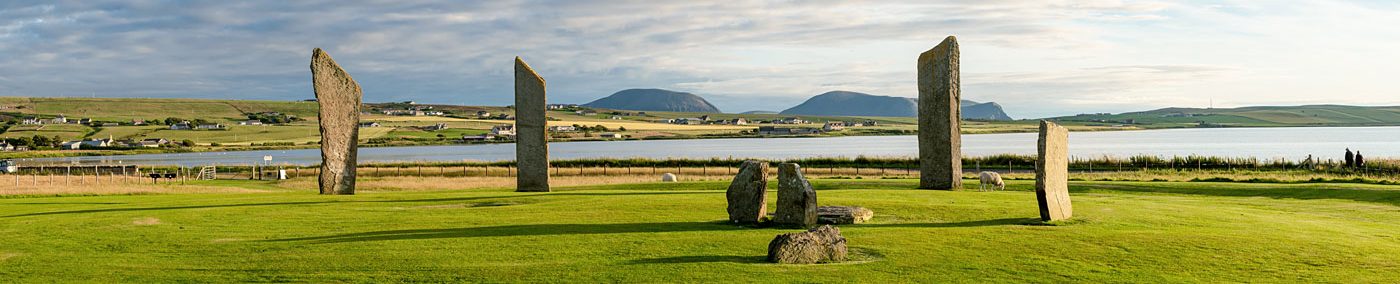
Skaefrue, Sandwick. Looking across the Stenness loch towards Hoy. (📷 Sigurd Towrie)
By Sigurd Towrie
Lying around 110 metres downslope and south-west of the Ring of Bookan is the large Bronze Age barrow known as Skaefrue.
The flat-topped, sub-circular mound is on a slope leading down towards the Stenness loch and survives at 24 metres in diameter and 2.4 metres high.
Little is known about Skaefrue. Described in 1851 as a “large conoid tumulus”[1], we know it was one of seven barrows to the west of the Ring of Bookan, all of which are now gone, and that it was the focus of an antiquarian excavation in August 1849.
This, however, was not the first investigation of the mound – an earlier cut into the south-western side had been abandoned after no structural remains were found.
A section of Captain Thomas’ 1849 map showing the Ring of Bookan and Skaefrue to the south-west.
Among the distinguished “ladies and gentlemen” present for the second attempt were Lieutenant Frederick Thomas, the visiting Royal Navy surveyor whose name will be familiar to regular readers, and Rev Charles Clouston, minister for the parish of Sandwick. It is thanks to them that any record of the operation to “lay open a tumulus of rather larger dimensions than the ordinary size”[2] exists.
On the afternoon of the second day, “after the part had partaken of a very excellent picnic on the green sward of the Druidical circle of Wasbuster [Ring of Bookan]” a cist burial was uncovered in the south-eastern section of the mound:
Lt Thomas’ plan of the three cist burials uncovered within Skaefrue in 1849.
“Dr Wall now directed attention to a few moderately large pieces of flagstone that had been passed when trenching in, when a few strokes of the pick soon made it apparent that we had hit upon some structure, and in a little while we came upon a grave. This was placed about halfway between the centre and circumference of the tumulus, that is, about ten feet from the centre and four feet above the natural surface. The top stone of the grave was a large unsquared slab, not made to fit in any way, but overlapping the sides considerably; this was very carefully cleared to prevent the earth falling in upon its removal.
“On lifting off the top stone, the grave was seen to contain a human skeleton, which was lying upon the right side, with the legs doubled close up to the abdomen. The large bones of the arms and legs were nearly and the skull was quite perfect; some of the teeth had fallen out, they were much worn but otherwise good. The bones of the spine and pelvis had decayed; no remnants of clothes nor ornaments could be detected.
“The grave was conjectured to be that of a female of full age, from the small size of the bones (femur 17 ¾ inches; tibia 14 1/8 inches), the decidedly marked attachments for the muscles, and the worn teeth.
“Though I do not attach much importance to the circumstance, it is necessary to state that the grave was in the direction of the prime vertical (east and west), and that the skull was in the north-west quarter, with the face towards the east.
“The sides of the grave were neatly built, but no bottom slab could be detected; it was evident that the occupant must have been squeezed in, probably swathed in the native cloth of the country.” [1]
A second cist was found in the north-western quarter. It contained the disarticulated remains of what Thomas’ concluded was a large man:
“It appeared to be of a ruder description than that previously described. The walls or sides were formed of single upright flags, and the covering stone, which had fallen in, had disturbed the contents.
“The grave contained nothing but the displaced bones. These had belonged to a large man, but on a comparison with the graceful proportions of my companion it was found the latter had undoubtedly the advantage in stature.
“Although this grave was placed opposite to the former, and at nearly the same distance from the centre, it was six or seven feet higher up in the tumulus, and not more than one foot beneath the surface.” [1]
Skaefrue from the south-east. (📷 Sigurd Towrie)
On the eastern side of the mound, a third cist was said to be the final resting place of a child:
“[The cist] was at nearly the same level with the last, perhaps a foot higher, and slightly nearer the centre; it was but one foot beneath the surface. This grave was still smaller than either of the others. The covering stone had fallen in; the sides, less than a foot in height, were formed by two placed stones upon each other.
“Only a few bones were seen; they had belonged to some young person, perhaps twelve or fourteen years of age.” [1]
Skaefrue. (📷 Sigurd Towrie)
The three cists, together with a speculated fourth – “the very large quantity of earth thrown on that side from the interior of the tumulus discouraged any attempt to search for it” – were, wrote Thomas “placed at the cardinal points of the compass”.
Thomas regarded the mound as a “family tomb for father, mother, and child” and considered the regularity of their layout purely coincidental:
“[At] the time this tumulus was erected the deviation of the compass-needle was very different to what it is now; they must therefore be considered as placed in a circle…”
Geophysics surveys of the area revealed a circular arrangement of anomalies around the base of the mound. Although these may relate to the 19 thcentury antiquarian disturbances, “it is likely that at least some of them are associated with the construction and use of this monument during the Bronze Age”. [3]
The archaeologists behind the ten-year project to survey the Heart of Neolithic Orkney World Heritage Site also noted the similarity between the Skaefrue geophysics responses to those at Mound Seven at the nearby Lingafiold barrow cemetery, which excavation has confirmed as an arrangement of funeral pyres and cists. [3]
Notes
[1] Thomas, F. W. L. (1851) XIII — Account of some of the Celtic Antiquities of Orkney, including the Stones of Stenness, Tumuli, Picts-houses, &c., with Plans, by FWL Thomas, RN, Corr. Mem. SA Scot., Lieutenant Commanding HM Surveying Vessel Woodlark. Archaeologia, 34(1), pp.88–136.
[3] Brend, A., Card, N., Downes, J., Edmonds, M. and Moore, J. (2020) Landscapes Revealed: Geophysical Survey in the Heart of Neolithic Orkney World Heritage Area 2002-2011. Oxbow Books, Oxford.