
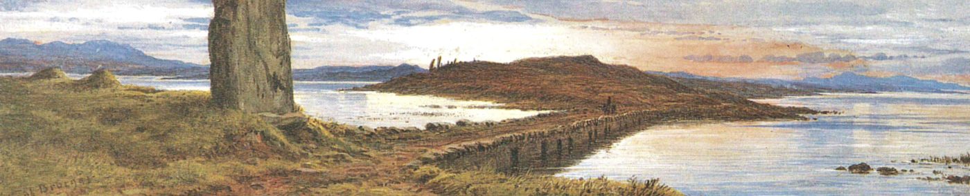
The Knap of Howar, Papa Westray

By Sigurd Towrie

Anyone following the unfolding story of Structure Five within these pages will have seen repeated comparisons between it and the Knap of Howar – a Neolithic settlement on the island of Papa Westray.
Until the early years of the 21st century, the two buildings at the Knap of Howar [1] had the distinction of being the earliest evidence of Neolithic settlement in Orkney.
Excavation has since revealed earlier sites and we now know that the stone-built Knap of Howar structures are probably not representative of the first Neolithic dwellings in Orkney.
The shoreside site, on the west coast of Papay, consists of two conjoined, sub-rectangular buildings. Aligned north-west – south-east, they have been suggested to represent a house and attached workshop.
Because it is unlikely that the two buildings had such clear-cut, singular roles for this article, the so-called “dwellinghouse” will be referred to as Structure One and the “workshop” Structure Two.
Threatened by the sea

Excavated in the early 1930s [2], the existence of prehistoric material had been common knowledge among the people of Papay for some time. [3]
Severe coastal erosion had been washing archaeology into the sea, with “each succeeding storm [sending] huge seas battering the face of the cliff and carrying away parts of the foreshore on which [the Knap of Howar] is situated.” [3]
Recognising the archaeology was under threat – and perhaps equally inspired by the excavation under way at Skara Brae between 1927-30 – the landowner William Traill and antiquarian William Kirkness moved in before “it was entirely swept away”. [3]
Structure One’s western doorway was uncovered in 1929 [4], with excavation following shortly after.
Like Skara Brae, the Knap of Howar buildings had been cocooned by sand, the excavation team having to clear a 2.4-metre-deep layer that completely filled both buildings. [3]
Structure One – the larger and best preserved of the two – had an interior measuring nine metres by 3.7 metres.
This space was divided into two roughly equal halves by a north-south line of four upright orthostats projecting from the interior walls.

Built into the eastern half of the northern wall, and 68 centimetres from floor level, was an “aumbry” – a small recess or cupboard – while a large saddle-quern, opposite, lay on the floor in the south-eastern corner. [3]
The southern side of the building was dominated by a low, raised platform, divided by thin orthostats. The excavators took this to represent a bed area [3] – probably based on the interpretation of similar features in Skara Brae.
Access to the interior of Structure One was by two entrances.
The western entrance, in the centre of the wall, led outside, via a 1.83-metre-long, 1.4-metre-high passage.
The second was in the northern wall and led into the adjacent Structure Two. Measuring 2.4 metres long, 76 centimetres wide and one metre high, the passage between the two buildings had door checks at the northern end, meaning it could only be secured from Structure Two.

Slightly smaller than its neighbour, the interior of Structure Two measured 7.5 metres by three metres and have been divided by orthostats into three distinct areas. The eastern compartment was the best preserved and featured a “series of cubicles or stalls round the [eastern] end”. [3]
Built into the southern wall were three “small cupboards of masonry” about 45cm above the floor level. There was no evidence to suggest how these might have been used.
Two pits had also been cut into the eastern area’s floor – the smallest of which contained sheep and cattle bone and a hammer stone. The second, which also contained some sheep and cattle remains, was interpreted as a well. Both pits had been covered by stone slabs. [3]
In the middle compartment were another two “cupboards” in the south wall. What was taken to be a partition, 76 centimetres from the northern wall, was also suggested to represent bed recesses akin to those at Skara Brae. [3]
A strange fixture for a so-called “workshop”.
Structure Two’s external door and passage was also in the western wall, facing the sea. The excavators found this, and the passage connecting the two buildings, had been carefully and deliberately blocked – suggesting Structure Two went out of use before its neighbour.
The fact that “evidence of the occupation of this settlement” [3] had been noted previously suggests there were more remains on the seaward side of the buildings. Whatever, if anything, stood there was long gone by the time of the excavation.
Despite the incredible preservation of the buildings, Traill and Kirkness found no artefacts that, at the time, would allow them to assign a Neolithic date to the Papay structures.
So, declaring that the Knap of Howar’s twin buildings had “no exact parallel in Scottish archaeology”, they placed them in the Iron Age:
Re-excavation

Over 40 years passed before archaeological activity resumed at the Knap of Howar.
The site had been “reluctantly” taken into state care in 1937 [5] and a sea-wall constructed to protect the site. But although this undoubtedly helped, the exposed structural archaeology had suffered over the years.
In 1973, it was decided to repair and consolidate the remains and, at the same time, excavate and look for dating evidence.
Two seasons of excavation took place – in 1973 and 1975 – with archaeologist Anna Ritchie at the helm. As well as re-excavating the two structures, areas of adjacent midden were carefully examined, and a series of test pits dug around the site to ascertain the extent of the midden deposits. [4]
The results showed the Knap of Howar – as had been suspected – was Neolithic.
There were problems with the radiocarbon dating but Ritchie suggested “the potential chronological range for Knap of Howar lies between about 2800 and 3800 BC”. [4]
Taking the artefactual evidence into account, she concluded that “the site represents the remains of a small Neolithic farmstead belonging to people who used Unstan Ware [pottery] during the period approximately 3500-3100 BC”. [4] We’ll return to these dates later.
Kirkness and Traill had focused on exposing the structure walls so the extent of their digging varied across the site. Fortunately, some areas of the floor deposits had been left undisturbed and the modern excavators were able to identify two main phases of activity.
A 40-centimetre-thick layer of midden represented the earliest occupation but, other than stone paving to the south of Structure One, there was no evidence of any associated buildings.
The second phase saw the two stone buildings built on top of the levelled midden mound and occupied. Structure One was erected first but, because the passage connecting the two was an integral part of the design, there was probably little or no interval before work construction work began on its neighbour. [4]
Structure One

Structure One was considered to be the main dwelling, which remained in use throughout the Knap of Howar’s second phase. [4]
In the paved western section, nothing remained of the occupation deposits except in the passage between the buildings. [5]
Differences noted in the surviving deposits, however, suggested the activities carried out in the building’s two sections differed, prompting Ritchie to suggest the eastern compartment was a work area. [4]
The eastern area was unpaved and contained a shallow, scooped hearth, approximately 80 centimetres in diameter. Ash from the fire extended into hollows around the fire – pits that may have been specifically to hold the round-bottomed pottery of the period. One of the hollows still contained a small pottery vessel, which had been covered by a large pot sherd. [4]
Cuts in the floor adjacent to the north wall were interpreted as bedding slots for a wooden bench. Another U-shaped feature by the south wall was represented by deep grooves. What this was, or how it related to the occupation phases of the building was not clear, with any evidence cleared out in the 1930s. [4]
The feature against the southern wall of the western section, interpreted by Kirkness and Traill as a bed, was described by Ritchie simply as a “low bench or platform” [4].
Structure Two

Although smaller, Structure Two had been constructed in much the same way as its neighbour. The two buildings were freestanding, meeting only at the point where the passageway connected the two. [4]
There westernmost section of the three areas inside was “featureless, apart from the two doorways”, while the east section “had apparently been used for storage”. [5]
This interpretation was based on the “cupboards” and “shelves” built into the wall [5] although, as Traill and Kirkness had previously noted, they were found to be completely empty.
This lack of artefacts prompted Ritchie to suggest that the building’s abandonment was “a deliberate and unhurried decision”. [5]
The central area, with its two successive stone hearths and a 20-centimetre-thick occupation deposit layer, was, the archaeologists concluded, a working area. The original hearth was bounded by stone slabs but its replacement was a shallow pit, akin to the one in Structure One. [5]
Traill and Kirkness’ “bed recess” against the northern wall was found to be an area of collapsed walling. Beneath them, however, were the lower courses of a stone bench/platform, one metre wide and 2.4 metres long. Grinding stones still lay on top of this fixture, which may have replaced an earlier wooden bench akin to the one suggested for Structure One. [5]
The lack of obvious roofing material in the buildings’ infill led to the conclusion that they must have been organic, i.e., turf or thatch. [5]
A Neolithic farmstead

Of the 56 bone and stone tools found, the majority came from House Two [4] – its neighbour having been cleared out by Kirkness and Traill in the 1930s.
Among these were flint, whalebone artefacts, stone borers, pumice and grinding stones.
The faunal assemblage suggested a “self-supporting farming unit” in which cattle and sheep appear to have been reared in equal proportions, with perhaps a few domestic pigs. [4]
Like those at the Ness of Brodgar, the cattle at the Knap of Howar were large [4] with half slaughtered in their first year – presumably for their meat, hides and bone. [5]
Interestingly, a whalebone macehead – akin to the one found in Ness of Brodgar Structure Eight in 2010 – was recovered from the earlier midden making up the wall core of Structure One.
This was the second recovered from the Knap of Howar, the first found by Kirkness and Traill in the 1930s. The site also produced two antler maceheads.
Although only a few grains of barley were recovered, wheat pollen found in a test pit suggests that cereal cultivation was more extensive than the evidence suggested. [4]
Like Orcadians of more recent times, farming at the Knap of Howar was supplemented by foraging, hunting and fishing. Wild birds appear to have been caught – for oil as well as consumption – and a very small amount of deer bone found in both occupation layers. [4]
Whale and seal bone shows these animals were being exploited but whether they were actively hunted or represent shoreside scavenging is not known. [5]
The faunal assemblage also included shellfish and fishbone. Dominating the shellfish assemblage was limpet – presumably used for bait – but also present were oysters, winkles, cockles and razorfish. The latter, collectible at very low tides, were presumably for consumption but Ritchie concluded “their contribution as a food source was negligible”. [4].
The fish remains suggested the occupants were not only fishing from the shore but venturing out into deeper waters to catch cod, ling and saithe. [4]
Ground seashells had been used in much of the pottery recovered [4] and Kirkness and Traill noted decades before: “We found ground shells in abundance on the floor where the saddle-quern stood…” [3]
In the report of their original excavation, Kirkness and Traill noted the discovery of “one fragment of human skull” that had been gathered up with “the rest of the bones”. [3]
Where it originated was not recorded but given that most of their clearing out took place in Structure One, this seems a likely candidate. Where it lay in the metres of infill, how it related to the buildings and their use or, indeed, whether it was actually a fragment of human skull remains unknown.
How old?

Until comparatively recently our understanding of the Neolithic in Orkney was delightfully simple.
It was split into the Early and Late Neolithic, each period conveniently having its own distinct type of pottery, houses and monuments. The Early Neolithic had Unstan Ware pottery, stalled cairns and, after its excavation, the Knap of Howar.
The Late Neolithic, on the other hand, had Grooved Ware pottery, Maeshowe-type cairns and circular houses such as those at Skara Brae and the Barnhouse settlement.
Within this framework, the presence of round-based pottery, including Unstan Ware, at the Knap of Howar suggested a mid-fourth millennium BC date.
Unstan Ware takes its name from the Unstan stalled cairn, in Stenness, where copious quantities were found during its excavation in 1858.
Shallow, round-bottomed, and with band of decoration around the rim, Unstan Ware had long been solely associated with stalled cairns. Its discovery at the Knap of Howar was the first time it had been found in Orkney in a non-funerary context.

For decades comparisons had also been drawn between the Knap of Howar’s stalled architecture and that of Orkney’s stalled cairns.
Because these cairns had come to represent the Early Neolithic and were thought to be a development of domestic architecture (we now know it’s the other way around – stone-built dwellings were inspired by tombs [6]) the similarities were seen as further evidence of an early date for the Knap of Howar.
As a result, the site – the only example of Early Neolithic Orcadian domestic architecture found in Orkney until the latter years of the 1990s – also came to be regarded as typical of the period…
…and the idea that the earliest farmers in Orkney lived in dispersed, isolated, single farmsteads took root.
But we now know things were not quite that simple. As Richards et al. put it in 2016 “…our images of a neatly ordered early Neolithic world are blurring and a new canvas is required.” [6]
A re-analysis of Orkney radiocarbon and luminescence dates in 2017 prompted a radical reassessment of Neolithic Orkney. Among the findings of the Times of Their Lives project was that both styles of chambered cairn were first built in the middle of the fourth millennium BC – “although, with current evidence, it is not possible to state which came first”. [7]
So, we now have a situation where it seems both types were used concurrently, although deposition of human remains in the stalled Orkney-Cromarty structures ended around 2900BC — four centuries before the practice ceased in the Maeshowe group. With both styles, however, activity continued after these dates, specifically the deposition of animal remains [7].
In addition, the authors found that “…it soon became apparent that round-based pottery […] and Grooved Ware […] were almost certainly in contemporaneous use during the thirty-first century cal BC, at the very least.” [7]
Long before 2017, however, excavation had shown that the Knap of Howar could not be considered typical of the Early Neolithic.
We now have several early settlements showing that nucleated villages were not just a feature of the Late Neolithic. In addition, the earliest dwellings in Orkney were not stone-built but timber. [6]
Radiocarbon dates

So where does that leave the Knap of Howar?
Published in 1983, the report of the 1970s excavation placed the occupation of the buildings between 3500-3100BC [4]. In 1985, referring to the radiocarbon dates, Ritchie wrote that the results placed occupation “between about 3700 and 2800BC”. [5]
In 1995, a date of 3600BC was given [8] and, in 1998, the two buildings were placed around 3700BC. [9]
However, the earliest Knap of Howar radiocarbon dates came from the remnants of the activity that preceded them – the midden underlying the buildings and which was incorporated into their wall cores. As such these dates do not represent the use of the two stone buildings but instead provide an earliest possible date for their construction.
Subsequent (and more recent) programmes of redating suggest a much later date for the site, placing initial occupation around 3500BC and the erection of the two buildings two centuries later, around 3300BC. [10]
This revised model places the construction of the Knap of Howar structure around a century before the piered buildings at the Ness of Brodgar (which share the same spatial arrangements) and at least 300 years after some of the dates published for the Knap of Howar in recent years.
The revised dates fit well with data from elsewhere in Orkney – particularly the evidence of early timber-built structures dating to c3600BC. [10]
Around 3300BC, the timber houses at the Wideford Hill settlement began to be replaced by stone-built dwellings – structures that replicated the architecture of the only stone buildings erected by this time, chambered cairns. This date, the excavators believe, heralded the switch from timber to stone across Orkney. [11]
This has interesting possibilities for the Knap of Howar.
The primary occupation deposits beneath the buildings clearly relate to an earlier settlement, but no evidence of this has been found.
In 1985, Anna Ritchie herself stressed that “it is inherently unlikely that developed settlements such as Knap of Howar… should represent the homes of the first pioneering colonists” adding that “there may have been a primary phase, as yet undetected in the archaeological record”. [5]
Could the lack of structural evidence at the Knap of Howar relate to that undetected primary phase? And if so, do we have a situation where it was a wooden building that occupied the site until c3300BC?
So, although the Knap of Howar may have lost its place as the earliest Neolithic dwelling in Orkney, there is no doubt that it remains the best preserved and, almost 100 years after it was first exposed, still provides an incredible glimpse of life in the final centuries of the fourth millennium BC.
Notes
- [1] From Old Norse haugar meaning mounds. Singular haugr, meaning mound, found today as Howe or How.
- [2] The excavation date is unclear. Canmore places the excavation in 1937. Given Kirkness and Traill’s report of the operation was published in the Proceedings of the Society of Antiquaries of Scotland in March 1937, it is highly unlikely this was the year of excavation. The 1937 date is presumably because that was the year the Knap of Howar finds were donated to the National Museum of Antiquities of Scotland. Ritchie (1983) states that Structure One’s entrance was uncovered in 1929 and this, together with the urgency with which Kirkness and Traill excavated before “it was entirely swept away”, suggests the operation took place in the early years of the 1930s.
- [3] Traill, W. and Kirkness, W. (1937) Hower, a prehistoric structure on Papa Westray, Orkney. In Proceedings of the Society of Antiquaries of Scotland (Vol. 71, pp. 309-321).
- [4] Ritchie, A., Bramwell, D., Collins, G.H., Dickson, C., Evans, J.G., Henshall, A.S., Inskeep, R., Kenward, H., Noddle, B.A., Vaughan, M. and Wheeler, A. (1983) Excavation of a neolithic farmstead at Knap of Howar, Papa Westray, Orkney. In Proceedings of the Society of Antiquaries of Scotland (Vol. 113, pp. 40-121).
- [5] Ritchie, A. (1985) The First Settlers. In Renfrew, C. (ed) The Prehistory of Orkney BC4000-1000AD. Edinburgh University Press.
- [6] Richards, C. and Jones, R. [eds] (2016) The development of Neolithic House Societies in Orkney. Windgather Press. Oxford.
- [7] Bayliss, A., Marshall, P., Richards, C. and Whittle, A. (2017) Islands of history: the Late Neolithic timescape of Orkney. Antiquity, 91(359), 1171-1188
- [8] Ritchie, A. (1995) Prehistoric Orkney. Batsford.
- [9] Wickham-Jones, C. (1998) Orkney: A Historical Guide. Birlinn: Edinburgh.
- [10] Griffiths, S. (2016). Beside the ocean of time: A chronology of Neolithic burial monuments and houses in Orkney. In Richards, C. and Jones, R. (2016) The Development of Neolithic House Societies in Orkney: Investigations in the Bay of Firth, Mainland, Orkney (1994–2014). Oxford: Windgather Press.
- [11] Richards, C. and Jones, A. M. (2016) Houses of the Dead: the transition from wood to stone architecture at Wideford Hill. In Richards, C. and Jones, R. (2016) The Development of Neolithic House Societies in Orkney: Investigations in the Bay of Firth, Mainland, Orkney (1994–2014). Windgather Press.
- [12] Richards, C. and Jones, R. (2016) Images of Neolithic Orkney. In Richards, C. and Jones, R. (2016) The Development of Neolithic House Societies in Orkney: Investigations in the Bay of Firth, Mainland, Orkney (1994–2014). Windgather Press.


