
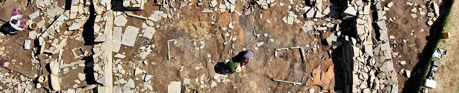
Geophysics suggests the Ness may not be as unique as once thought

(📷 ORCA)
By Sigurd Towrie
When the Ness of Brodgar complex was discovered in 2003, it was without parallel. A huge, 2.5-hectare site that was occupied for most of the Orcadian Neolithic and featuring a conglomeration of large, monumental buildings.
Similar structures had been found before – Houses Two and Eight at the Barnhouse Settlement, for example – but at the Ness there was an entire complex of these “big houses”. Nothing like it had been encountered in Orkney before so it was hailed unique.
But we now suspect it wasn’t.
A second site, lying less than two miles to the north-west, appears to be on a par with the Ness of Brodgar – both in terms of area and the size of some of its buildings.
Between 2002 and 2011, over 285 hectares around the Heart of Neolithic Orkney World Heritage Site were geophysically surveyed. This revealed many new sites, including what appears to be a substantial Neolithic settlement overlooking the Loch of Harray.
The settlement is represented by three distinct areas just over half-a-mile to the north of the Ring of Bookan.
The first sits on a ridge of high ground and covers an area of 140 metres by 100 metres. The geophysics suggest it contains substantial stone buildings surrounded by occupation deposits and midden.
From the scan results it seems the buildings in this section have not survived well, probably due to stone-robbing and agricultural work over the centuries. The clearest examples suggest they were very large, in at least one case 19 metres by 14 metres.
Around these buildings are spreads of magnetic enhancement, perhaps indicating the use of midden to enrich the soil – a situation encountered at the Toftsness site in the Orkney island of Sanday.
To the north is a large rectangular anomaly measuring 130 metres by 110 metres. The survey results suggest this may represent an enclosure – perhaps a field system – surrounded by a huge ditch. At 12 metres wide, this ditch is slightly narrower than the one enclosing the Ring of Brodgar to the south-east.
Geophysics cannot tell us whether this feature is contemporary with the settlement area or whether it post-dates it. The patterning, however, suggests an infield arrangement surrounding a Neolithic settlement.
Moving to lower ground, some 130 metres to the north-east is another geophysical anomaly that, together with hints of wall lines and occupation deposits, may represent another area of settlement.

The high levels of magnetically enhanced soil in this area obscure the possible structures making it difficult to ascertain their size and form.
It may be that the buildings are heavily truncated – perhaps partially dismantled and covered in midden, as was the case at the Ness of Brodgar site – or simply that soil from upslope has washed over their robbed remains. The features that can be made out, however, are very similar in layout to other Neolithic settlements in Orkney.
The third probable settlement area is 250 metres to the south-east and represented by a geophysical anomaly c.70 metres by 50 metres. The situation here is slightly more complicated due to the presence of a suspected Iron Age enclosure a short distance to the north-west.
Although this area could relate to later Iron Age activity, fieldwalking by Chris Gee has recovered a range of artefacts suggesting a Neolithic date. If that is the case we may have a situation similar to that at Howe, in Stromness, where a sequence of Iron Age constructions sat on top of earlier Neolithic buildings.
So what do these three areas represent?
That would require excavation to know for sure. Dating evidence is required to say whether the three are contemporary or separated by time. They may represent distinct areas of settlement or be part of a much larger settlement at the north-western end of the Ness of Brodgar. Alternatively, they could be the result of shifting settlement up and down the hillside.
If the former, then we are looking at another massive settlement in the vicinity of the Ness of Brodgar isthmus.
And like the Ness complex itself, the complexity of the geophysics suggests the north-western site saw repeated episodes of construction, demolition and alteration.
Notes
- Brend, A., Card, N., Downes, J. and Edmonds, M (eds) (2020) Landscapes Revealed: Geophysical Survey in the Heart of Neolithic Orkney World Heritage Area. Oxford: Windgather/Oxbow Press.
- Dockrill, S.J., Bond, J.M., Nicholson, R.A. and Smith, A.N. (2007). Investigations on Sanday. Vol 2. Tofts Ness: An island landscape through 3000 years of Prehistory. Kirkwall: The Orcadian.


