
Geophysics hints at Iron Age chamber in the monumental midden mound

By Sigurd Towrie
It has been surveyed and we excavated into its side, but the nature of the Iron Age additions to the huge midden mound at the south-eastern end of the Ness of Brodgar has long remained unclear.
Following last year’s geophysical surveys, however, we may finally have a clue. Evidence suggests the circular Iron Age structure that once stood atop the mound could have been associated with an underground chamber.
But before we consider the new data, it is worth revisiting the background.
Although the Ness of Brodgar is best known for its Neolithic archaeology, the isthmus remained a focus of activity throughout later prehistory and into the historic period. While the Ness complex was abandoned around 2500BC, at least part of the site was reoccupied approximately 1,800 years later, during the Iron Age.

(📷 University of Aberdeen: George Washington Wilson photographic archive)
Near the south-eastern tip of the Ness lies a substantial mound, now known to comprise accumulated deposits of midden material – Neolithic occupational refuse. Measuring approximately 70 metres in diameter and at least four metres deep, it remains clearly visible across the surrounding landscape.
At its maximum extent it must have rivalled, in visual impact, the monumental stone architecture that once dominated the north-western end of the site.
Although the mound is a shadow of its former self, we know that it remained a major landmark until the 1880s, when the field was partially quarried, levelled and squared off. This operation reduced the height of the mound and obliterated whatever structural remains survived on the summit.

(📷 University of Aberdeen: George Washington Wilson photographic archive)
In Magnus Spence’s 1907/08 account of Orkney’s bonfire traditions the Ness mound was still imposing enough to warrant a very brief mention. Spence did, however, give its name and informed his readers that ash and burnt stone lay on its surface.
Like most Orcadian placenames, Kok-na-cumming is simply descriptive.
Kok, in Orcadian dialect, means heap, usually in reference to seaweed. Here it may relate the mound itself. Cummeen (Orcadian pronunciation of Cumming – compare to Cuween/Kewing in Firth), I would argue, was the name of the field, incorporating kummle, a mound or prehistoric site showing evidence of some old burial or memorial structure, and eng, a meadow.

Visiting in 1848, Lieutenant Thomas shows the “tumulus” on his map of the Ness of Brodgar: describing it in his 1851 publication, Account of some of the Celtic antiquities of Orkney:
Because of its size, the mound was long thought to conceal a Neolithic chambered cairn. Early geophysical surveys identified a series of concentric anomalies midway up its slope. Initially these were interpreted as the remains of a broch-like structure, before attention shifted towards the possibility that they represented the retaining walls of a Maeshowe-type cairn.

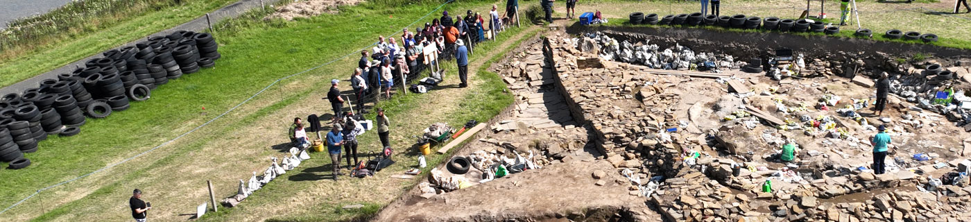
To investigate these anomalies, Trench T was opened in 2013. Excavation quickly showed that the circular features were not Neolithic but stone revetment walls associated with an Early/Middle Iron Age ditch, dated to between 700BC and AD200.

The ditch had been cut into the upper slopes of the midden mound, enclosing its summit. Within it was evidence for a three-metre-wide revetted bank, beneath which were recovered two human teeth and a toe bone. At the end of its life the ditch was filled in with a substantial volume of rubble.

A 19th century survey of the area by Orcadian antiquarian George Petrie and Sir Henry Dryden, a regular visitor to Orkney, suggests the ditch was continuous, enclosing an area c.35 metres in diameter.
This was backed up by the initial geophysics results, which also suggested there was an entrance on the south-eastern side, facing the Brig o’ Brodgar, the Stones of Stenness and the putative broch at Big Howe.
Why dig a ditch and raise a bank on top of the mound? What were the Iron Age builders enclosing?
Petrie and Dryden’s 1851 survey also suggested that a circular stone construction, c.12 metres in diameter, once stood at the centre of the enclosure – something corroborated by the geophysics.
The fact that a recognisable structure survived on top of the mound until the mid-19th century also fits with the use kummle placename element – “a mound or prehistoric site showing evidence of some old burial or memorial structure”.
However, the nature of this circular structure remained elusive.Why dig a ditch and raise a bank on top of the mound? What were the Iron Age builders enclosing?
All that was known was that the structure was too small to be an Iron Age broch and that elements of it survived until at least the 1850s. Although fragments of Iron Age pottery were recovered from the ditch fill, they were too few in number to indicate any prolonged occupation.
A programme of magnetometry, resistivity surveys took place in July 2025. These were carried out at a higher resolution than previous scans, the goal being to seeing what might lie in the areas outside the excavation trenches. To complement these, Time Team carried out a complete sweep of the site using Ground Penetrating Rader (GPR)
Unlike magnetometry and resistivity, which primarily provide plan views of archaeological features, GPR generates successive depth slices that can be combined to create a three-dimensional model of the buried archaeology.
And the results suggested something we had been pondering for some time. An underground chamber deep in the mound!

The anomaly lies at least two metres below the surface. It appears square in plan, measuring approximately three metres across, and narrows into a north-east/south-west-aligned linear feature visible through successive time slices. This seems to originate beneath, or immediately adjacent to, the wall of the overlying structure.
Given the excavated evidence for Iron Age modification above ground, the anomaly may represent a souterrain, or earth-house as these underground or partly subterranean stone-built chambers are known in Orkney.
Typically dating to the Iron Age, souterrains usually comprise of a long, underground entrance passage leading to a small, low chamber. A handful were “investigated” in the 19th century, but many unanswered questions remained.
Their association with what were thought to be overhead dwellings led to the long-held assumption souterrains had a purely domestic function – usually storage. Needless to say, while it remains possible, the old interpretation is open to challenge.

Subterranean Iron Age chambers have been broadly placed into two categories – the souterrain, above, and the “broch well”.
The latter were long dismissed as simple “wells”, “cellars” or “cisterns” and, again, considered to be purely functional – usually a source of water. The seemingly obvious fact that these “wells” went far beyond that required for a simple water source did little to dispel the notion they were purely utilitarian.


It took the 1999 “rediscovery” of Minehowe to radically alter perceptions of subterranean Iron Age architecture in Orkney.
Excavations led by Nick Card and Professor Jane Downes between 1999 and 2005 revealed a remarkable two-storey structure, built within a natural glacial mound with two steep flights of steps descending to a subterranean chamber. Work at the top of the mound suggested an above-ground structure that may have served as an entrance.
Although Minehowe incorporated elements of broch architecture, few would now argue that the complex was merely a water source or storage facility.
The chamber occupied the centre of a deliberately monumentalised landscape, enclosed by a substantial ditch that physically and symbolically separated it from the world beyond.

(📷 Sigurd Towrie)
The combination of mound, ditch and underground chamber created a distinct and controlled place, one in which movement was structured and access restricted. The architectural emphasis seemed to have been about creating a setting for activities removed from everyday life.
Although much smaller in scale, the Iron Age remodelling of the Ness midden mound appears to employ similar devices. Here too, a prominent mound was encircled by a ditch that defined and enclosing a special area focused on a central structure.
Three-hundred metres to the south-west of Minehowe, however, is a closer parallel to the Ness ditched enclosure. Until its excavation in 2003, Roundhowe was considered to be the remains of a small, but “greatly mutilated”, broch surrounded by a large ditch.
Excavation showed that it was no broch, although it remains unclear what it actually was. A bank once stood within the ditch, which was dated to the Late Bronze Age/Early Iron Age.
As at the Ness of Brodgar mound, there was no evidence of occupation at Roundhowe – in fact there was little evidence of use whatsoever.

Given the Iron Age penchant for incorporating earlier buildings into their constructions, we might also be looking at the re-use of a chambered or stalled cairn, such as occurred at the Knowe of Rowiegar, Rousay. Here, the central area of the huge stalled cairn was converted into a souterrain, between 200BC and AD200.
This reuse of Neolithic buildings in the Iron Age is not uncommon and we know that Iron Age Orcadians continued to use, and respect, earlier prehistoric sites.
Another fine example is the Quanterness chambered cairn, where a roundhouse was built into the front of the Neolithic structure. Here the Iron Age builders not only incorporated the earlier building into theirs but took great care not to disturb the original entrance.
Whatever the Iron Age construction at the Ness of Brodgar represented, there can be little doubt that it was intended to be highly visible within the surrounding landscape. Its position at the south-eastern end of the Ness must also have been significant, given the isthmus’ role as a natural route between the Lochs of Harray and Stenness.

Yet visibility alone is unlikely to explain the choice of location. The monument occupied a landscape already crowded with ancient monuments and enduring memories.
By building on, and into, the Neolithic mound, the Iron Age community was engaging directly with a past that was already more than two millennia old, drawing upon the authority and significance of that ancient landscape. In essence, creating a bounded and highly visible place whose importance derived as much from its association with the distant past as from any activities that took place within it.
By the time we excavated the top of the Ness mound, there was no trace of any Iron Age feature or structure. Whatever once stood there has, unfortunately, been lost to history. But the fact the Ness of Brodgar attracted Iron Age attention should come as no surprise.
Not only do we have the suspected broch site at Big Howe, a short distance away from the Standing Stones of Stenness, but the 1906 operation to re-erect the fallen megaliths within the stone circle produced 51 sherds of Iron Age pottery, dating from between 50BC to AD300.
In addition, one of five pits discovered during the 1973/74 excavations, to the south of the monument’s central hearth, produced a piece of charcoal that was radiocarbon dated to between AD100-1050. This pit is thought to be contemporary to the others, due to the pottery and a stone tool found in those.
Viewed together, these strands of archaeological evidence suggest that the landscape around the Ness and the Lochs of Harray and Stenness was not simply inherited by Iron Age communities but actively incorporated into their lives. Ancient mounds, standing stones and monumental ruins seem to have retained a significance that endured for millennia.


