
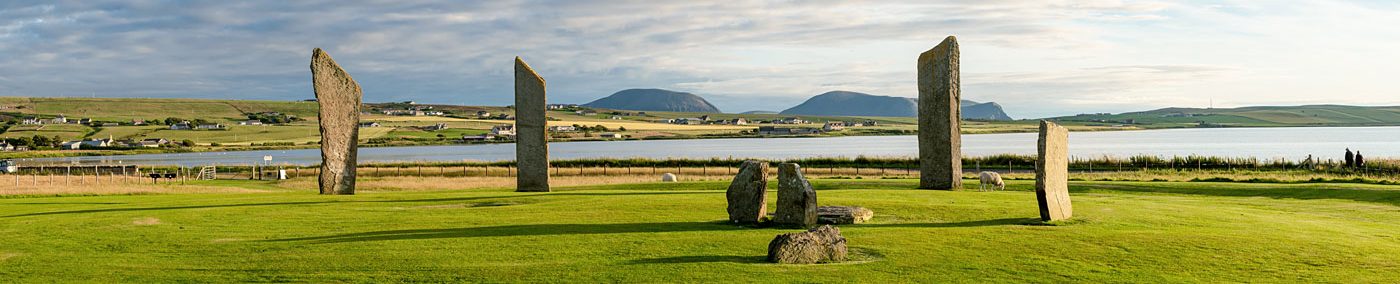
Human remains, pits and a stunning decorated stone – seasons 2014-2015
The fifth installment in our series looking at how excavation at the Ness of Brodgar progressed – and ideas changed – over the years, through dig director Nick Card’s annual brief summaries for Archaeology Scotland’s Discovery and Excavation in Scotland.
Today it’s the turn of the 2014 and 2015 seasons.
2014

Further investigation of the Neolithic complex on the Ness of Brodgar was undertaken, 14 July – 22 August 2014. The main structures were further investigated to clarify their relationships and the individual biographies of each building. Micromorphic sampling of both floors and middens again complemented other sampling strategies.

Excavation of the complex occupation-derived deposits within the later phase of Structure 1 continued.
Irregular cuts were exposed which appear to have held upright stones, suggesting that internal furniture was removed prior to the latter phase of use/remodelling (similar to Structure 14). Very thin interleaving occupation-derived lenses were excavated around the hearth and to the W of the eastern central pier. These were heavily worn and compacted, and sealed a clay floor layer (unexcavated).
Excavation in the NE alcove revealed a similar clay floor and cache of stone tools in a niche.
A cut for the hearth of the main secondary phase was exposed which truncated earlier occupation horizons, suggesting the hearth had been realigned or recut.
A large sub-oval pit was excavated to the NE of the hearth. It contained a single fill, with a stone tool placed at the E end, suggesting rapid infilling.

In Structure 8, work concentrated on the S half of the building to bring it into phase with the exposed N half. The remaining midden infill and collapsed stone roofing slates were removed and floor deposits exposed.
Potentially, three new hearths were revealed mirroring the hearth arrangement in the N half.
Several polished stone items were recovered from the floor surface including a macehead, spatulas, and a ‘pillow stone’ from a small cist-like feature adjacent to one of the hearths.
Work within Structure 10 concentrated on the internal floor deposits relating to its secondary major phase and the removal of the last of the fill of the internal wall robbing. This revealed several drains under the walls, and also a very large entrance threshold slab, c1.5 x 0.7m in the E wall that defined the entrance that had been deliberately blocked.

Outwith Structure 10, another sondage was excavated through the massive animal bone deposit that surrounds the building and recorded in 3D. Initial analysis of the results would suggest a similar sequence of structured deposition.
Detailed recording of Structure 11 to the SE of Structure 1 was undertaken, including elevation drawings of walls. Ephemeral occupation-derived deposits were exposed and partly excavated in the N part of the internal area. These were found to surround a small square central hearth defined by upright stones, which remains unexcavated.
Externally, wall faces were fully exposed following the removal of section baulks and were shown to have undergone a series rebuilds and shoring due to collapse.

Excavation in the interior of Structure 12, with the removal of more secondary occupation material, revealed more of its complex history.
In its primary form this structure had potentially three entrances: one in the NW corner, one in the S end wall and a third adjacent to the central pier in its E wall. This latter entrance was flanked externally by two standing stones.
At the end of this phase, due to subsidence and partial collapse (at least three earlier buildings have been identified under Structure 12), much of the internal wall face was dismantled and then rebuilt. Although this rebuild followed the original plan, it was undertaken with less care and attention to detail with pecked dressed stone-faced inwards and piers rebuilt slightly off alignment.
A new entrance was punched through the N wall with an external porch/annexe, while the NW and S entrances were blocked.

Excavations in Structure 14 focused on removing a complex sequence of floor and occupation deposits.

Two main phases are apparent. In the earliest phase the building is divided into two halves.
The E half contains many orthostats which form room divisions and possible benches around the hearth, while the W half is more open with orthostat divisions only in the recesses.
In the second phase, the majority of the orthostats were removed and floors of orange/yellow glacial clay and grit were relaid on several occasions.
These floor deposits are particularly thick around the hearths and it was apparent that trample was most intense around the E hearth. The position of the orthostats and a small number of pits and postholes can be paralleled in Structure 2 at Barnhouse.
In addition, a small 1 x 1m sondage was excavated to natural clay, where the N wall of Structure 14 had been entirely truncated by a late-phase pit. This revealed that archaeological deposits in this area of the site are 1.3m deep and 0.7m of deposits exist below the foundations of Structure 14.
The stratigraphy in the sondage comprise three main units:
- a series of occupation deposits c0.2m deep that directly overlie natural clay, which yielded round-bottomed pottery vessels and one possibly carinated sherd that probably dates from the Early Neolithic;
- a N–S wall probably relating to an early building that had been extensively robbed;
- a series of midden deposits.
The latter were truncated by the construction of Structure 14.
Limited excavation was undertaken within Structure 19 to the E of Structure 1. A possible oven in the N part of the structure was fully removed. The hearth and floor levels remain unexcavated.

The N corner of Structure 21, to the W of Structure 1, was fully exposed. The external walls continue into the trench baulk to the W and within the sondage to the S.
On the N side, the external and internal wall faces survive, including a pier, and display the same high quality of masonry found in other buildings. To the E, the building has been robbed of stone down to foundation level.
Occupation-derived deposits and patches of clay floor were exposed internally, but remain unexcavated.
Structure 25 was revealed following the removal of the sequence of ashy midden layers and section baulks to the S of Structure 1.
The lower courses of various stone walls that make-up Structure 25 may not have formed a roofed building, but appear to have focused movement through a passage between parallel walls to a large upright standing stone which aligns directly upon the S entrance of Structure 1.

The structure appears not to contain a hearth or occupation-derived deposits. When extant, the walls would have formed a series of passageways adjacent to Structures 1 and 11. Structure 25 was subsequently reduced to foundation level and sealed by a deep series of ashy midden layers and soil horizon that extend into the Central Midden Area (CMA).

The CMA between Structures 8, 11 and 12 was further investigated utilising 1m square ‘chequerboard’ excavation. This confirmed several phases of midden deposition, with the lower ones separated by rubble deposits with ephemeral wall lines representing the remains of temporary structures during the deposition sequence.
Trench T, near the southern tip of the Ness, was extended with the objective of further defining the character and date of the construction of the mound. Due to the complexity of the midden deposits that form the midden mound, these deposits were excavated in a series of 1m squares in a chequerboard pattern.

Within the eastern trench extension, the extensive rubble was shown to continue and to be roughly concentric on the centre of the mound. The northern extent of the rubble was found to be bounded by a new wall.
To the N of the wall were two E–W linear cuts, dug into a midden deposit that makes up part of the upper slope of the mound. One linear contained a human molar, premolar and toe bone, along with several Iron Age pot sherds. These features cut into and clearly postdate the main phase of accumulation of the midden mound. Moreover, they are of similar character and can all be assigned to the same broad phase of mound remodelling probably in the Iron Age.

The new wall suggested that two parallel foundation cuts were dug, a depth of midden of at least 0.5m between the two foundation cuts was stripped away, and then two revetment walls were constructed.
At an unknown point after the construction of these walls a series of rubble dumps were laid between the two walls. The area between these two walls sloped from N to S exaggerating the existing slope of the mound and creating in effect a revetted ditch running around the upper slope of the mound.

Augering and excavation of the main midden mound revealed that it was at least 3m high. Large unabraded sherds of Grooved Ware within the midden confirmed its Neolithic date.
The mound consisted of a series of individual midden heaps with signs of variability in the material in each dump.
Towards the top of the mound a sequence of formal deposition seems to have occurred involving the capping with clay of previous midden deposits, the placing of a very large cattle skull and numerous other animal bones, the dumping of a layer of midden material and then the placing of pot sherds on the top of this layer.
Prior to the commencement of the deposition of this monumental midden mound the area was stripped of topsoil and several quarry (?) pits were dug. Into one of these pits a large orthostat/standing stone was inserted.
More examples of Neolithic art and the use of pigments were also discovered.
2015
Further investigation of the Neolithic complex on the Ness of Brodgar was undertaken, 6 July – 28 August 2015. The main structures were further investigated to clarify their relationships and the individual biographies of each building.
Micromorphic sampling of both floors and middens again complemented other sampling strategies, including archaeomagnetic. The rerouting of the water pipe that ran through the middle of the site allowed several crucial relationships to be determined.

Trench T near the southern tip of the Ness of Brodgar Peninsula was extended to the S on the edge of the mound, with the objective of further defining the character, date and construction of the mound and to investigate the nature of structural remains exposed in 2014.
In the extension, the topsoil sealed a colluvial soil, which overlay the fills of numerous shallow Neolithic pits, many of which were intercut. The fills of the pits were similar in character, being derived from homogenised redeposited midden that was rapidly backfilled.

A total of 23 pits were excavated, which varied from 0.4–2.8m in diameter. The pits were cut through a sequence of well stratified midden deposits, which formed the southern flank of the main midden mound and were relatively late in the sequence.
These midden deposits sealed undulating spreads of rubble and redeposited glacial till that derived from the robbing of Structure 27.

The exposed elements of Structure 27 consist of a NE/SW orientated wall, a parallel stone-lined drain and five orthostats which form two linear arrangements, one orientated NE/SW and the other perpendicular to this alignment. The orthostatic arrangement bears comparison with the nearby tomb at Bookan.
Further excavation was also undertaken in the sondage through the midden mound, which is formed of numerous individual midden heaps. A degree of spatial patterning was apparent in the deposition of midden material between different heaps.
The northern heap was rich in cultural material, and had several concentrations of pottery and animal bone at different levels, whereas the southern heap contained comparatively few artefacts.
At the base of the midden heap were features and deposits which may relate to the northern portion of Structure 27, these comprised:
- A small NE/SW orthostat and associated linear cut
- Redeposited glacial till and rubble layers
- A stake-hole and two laminated layers of sediment which contained stone dressing fragments
- An anvil stone
- A stone roofing slab.

Excavations continued on the final Phase 2 occupation derived deposits inside Structure 1.
Numerous thin ashy layers and floor patches were excavated around the hearth to expose the rammed yellow clay floor. This floor was not continuous and was more extensive to the E of the hearth. Phase 1 occupation deposits (which continue below the large Phase 2 wall) were exposed in the recesses beyond the clay floor, but remained unexcavated this season.
A near complete articulated neonate skeleton was found in the southern corner of the W recess in the upper fills of a drain.

In the northern part of the original Structure 1, beyond the substantial Phase 2 wall, the water pipe baulk was removed and excavations continued to expose the uppermost occupation-derived layers.
These continued below the Phase 2 wall to the S and are part of Phase 1 occupation. The northern entrance had been disturbed by a substantial pit cut which may have been associated with the robbing of the NW internal corner buttress.
A substantial stone-lined drain was found to the W of the robbed entrance and may have been part of the original layout, draining the now robbed NW part of the structure. To the E of the structure, a paved area was removed to reveal the external wall face and the drain which continues S along the intramural passage (with Structure 19).

Work within Structure 8 revealed its full extent with excavation in its S half to bring it into phase with its N half.
Removal of a sequence of midden and rubble deposits at the intersection of Structure 8 and the Central Midden Area (CMA) revealed the southern end of Structure 8, basically a large deep recess with no evidence of an entrance to reflect the northern entrance.
The height of the surviving masonry and the alignment of this recess are also consistent with the earlier Structure 17, on which Structure 8’s southern half is constructed, suggesting that this recess may have originally been part of Structure 17.

The baulk between Structures 8 and 10 was also removed to expose more of the paving and outer revetment around Structure 10.
Much of Structure 8 in this area had been removed to allow their construction; however the remains of a heavily robbed pier were exposed, mirroring a ‘double pier’ to the W built on top of an earlier pier related to Structure 17.

It is possible the heavily robbed pier found in 2015 was the lower course of such a double pier, and also related to Structure 17, with the upper, robbed portions of the pier related to Structure 8.
The excavation of this baulk also entailed the excavation of a robber cut which targeted the NW corner of Structure 10 and removed its outer revetting wall, outer pavement, and exterior wall face in this area.
Underlying this robber cut were midden deposits, potentially indicative that any remains of Structure 8 in this area were totally removed.
Work within Structure 10 again concentrated on the internal floor deposits relating to its secondary major phase.
With the removal of the water pipe baulk the last vestiges of the fill of the internal wall robbing were excavated to reveal the surviving wall core, particularly around the SW corner of Structure 10.


Several large pick-dressed slabs were both recovered from the infill but were also built into the wall core. It is thought that these were reused after the original SW corner had collapsed and that the dressed stone originally was on display as part of the inner wall face of the primary phase chamber before Structure 10’s remodelling.
The remaining occupation-derived deposits in Structure 11 were removed from around the hearth, demonstrating that it was cut into the underlying material abutting Structure 17.
Following the removal of the water pipe baulk, the northern end of Structure 11 and southern end of Structure 19 were exposed and their relationship investigated.
Floor deposits and levelling layers around the hearth in Structure 19 were investigated in quadrants, focusing on the area adjacent to Structure 8. This suggests that Structure 19 was constructed upon material that abuts Structure 17 and cuts into the side of Structure 8.


Excavation within Structure 19, which was partially constructed into the outer face of the SW wall of Structure 8, revealed a beautiful example of a finely-incised decorated slab, with close parallels to the original Brodgar stone discovered in the 1920s, built into Structure 8’s wall core. This would not have been visible when the building was in use.

Excavation in the interior of Structure 12 continued with the removal of more secondary (?) ephemeral occupation layers and the last remnants of collapse.
A large spread of material close to its SW corner concealed a potential large inclined posthole, probably inserted to counteract the subsidence and collapse Structure 12 experienced. The eastern side entrance was further investigated and more of the two flanking standing stones exposed.
Outwith the primary phase blocked southern entrance, a large spread of Grooved Ware was uncovered.
Excavations in Structure 14 continued to focus on the removal of the complex sequence of floor and occupation deposits. This emphasised the major two phase biography of the building as revealed last year.
Many pits, smaller features, and cuts for orthostats were excavated within the floors.

The central midden area between Structures 1, 8, 11 and 12 was further investigated. This confirmed several phases of midden deposition, with the lower ones separated by rubble deposits with further ephemeral wall lines appearing during the deposition sequence.
Other more substantial structural remains started to appear that may represent more of Structure 23 that partially underlies the N end of Structure 12.
At the S end of Structure 1 more of the paving around the central standing stone was revealed. It seems probable that this will continue under the remaining midden to the south of Structure 8.
More examples of Neolithic art and the use of pigments were also discovered.


