
The Stonehall settlement – part one

By Sigurd Towrie

Sitting in the shadow of the Cuween chambered cairn, the Stonehall settlement lies a few miles to the west of Crossiecrown, Wideford Hill and Smerquoy.
Founded in the fourth millennium BC, occupation at Stonehall ran into the third millennium BC, following the pattern of conglomeration and nucleation noted at other Neolithic settlement sites in Orkney. [1]
Excavation between 1994 and 2000, as part of the Cuween-Wideford Landscape Project [2], revealed an extensive site with three areas of contemporary occupation, each notably different in character and architecture [3]:
- Stonehall Knoll
- Stonehall Meadow
- Stonehall Farm
Further occupation is possible beyond the three areas investigated.
Stonehall knoll
A prominent mound at the bottom of Cuween Hill was the first of the landscape features investigated on site.
Although it had been suspected to be another chambered cairn, excavation revealed evidence of occupation, including midden deposits, flint debitage and sherds of round-based pottery.
A larger trench on top of the mound exposed the remains of two sub-circular buildings with a third further downslope.
The natural glacial mound was found to be the site of a series of stone structures spanning a 4,000-year period. The most recent of these, House Six, was a Pictish building, dating to AD380-550, that incorporated two earlier Iron Age structures (Houses Four and Five).
Beneath these late constructions were three Neolithic buildings dating from the late fourth millennium BC to the early third millennium BC.
Structure One

The earliest Neolithic activity was represented by two large post-holes, stone walling and features that had been sealed beneath a later area of paving.
Because evidence for Neolithic timber structures in Orkney had yet to be revealed, the possibility that the two post-holes might relate to a wooden building was not considered at the time of excavation. With hindsight, however, the excavators consider that:
The surviving wall sections belonged to a small, probably oval, building orientated north-west to south-east with a presumed south-western entrance. It had been dismantled but two orthostat fragments suggested that, typical of the period, the interior had been divided by pairs of stone slabs.
No evidence of a hearth was found, leading the excavators to conclude that Structure One was unlikely to have been a dwelling.
It sat on top of the mound, in a central location, “a prime position that was curiously avoided by each of the subsequent Neolithic buildings.”
Why was this small structure given such a prime, elevated location overlooking all other areas of habitation in the area? And why was the site not re-used?

(Calder. 1937. A Neolithic double-chambered cairn of the stalled type and later structures on the Calf of Eday, Orkney)
Although they felt the structure was unlikely to have been a burial place, the excavators pointed out its similarities to an earlier building that was “absorbed” into the fabric of the Calf of Eday Long chambered cairn.
In their 1989 publication, The Chambered Cairns of Orkney, Davidson and Henshall believed the Calf of Eday Long’s incorporated structure was an early chambered cairn, despite the fact it fitted no known pattern. [4]
Back at Stonehall, the excavators concluded:
The lack of a hearth suggests the building was not a dwelling. But whatever role it served, after it was dismantled the top of the mound was levelled with a layer of yellow clay and the area paved with flagstones.
House Two

The creation of the paved area is associated with the construction of a second building to the west of Structure One. It seems likely the stone removed from Structure One was re-used to raise its successor.
Little remained of House Two, its walls having been completely removed. Only the hearth had survived reasonably intact, the remainder of the structure presumably having been removed and the stone used elsewhere.
The fact House Two had been raised on top of the clay layer covering the remains of Structure One suggests that the remodelling of top of the mound was all part of the same plan.
House Two seemed to have a linear footprint with its interior divided by three sets of paired orthostats. Its entrance, at the east-northeast side, overlooked the mound’s steep eastern slope. Excavation suggested the occupants regularly, and repeatedly, dumped ash down this incline.
The steep gradient means direct access to the entrance would have been difficult, suggesting it was approached from a different direction. Whatever the reason for this, as excavation progressed it became clear that summit of the mound was a highly desirable location.
As the excavators explained:
House Three

Around 3300BC, House Two was demolished and another, larger, structure raised. Although the pattern noted at other sites (e.g. Barnhouse and the Ness of Brodgar) was to rebuild on the same site or partially, the builders of House Three avoided re-using the site of its predecessor.
Instead they shifted their new construction to the north – a requirement that saw the building plagued by structural problems throughout its life and which resulted in its occupants caught up in a “continual programme of maintenance and repair”. [3]
There is no doubt that building House Three on the centre of the mound was a better option but one that was presumably, for whatever reason, forbidden. Or at the very least, frowned upon.
But although they shunned the area where it had stood, stone from House Two was “almost certainly” used in the construction of Three. [3]
Whatever the benefits of dwelling in the elevated position atop the mound were, they must have greatly outweighed the drawbacks of having to build across the two slopes to the north of House Two.
To alleviate this the builders cut back into the hillside, creating a level platform for construction – a technique also used upslope for the building of the Cuween Hill chambered cairn.
But their new construction was structurally unstable and left the occupants repeatedly tackling subsidence to stave off the threat of collapse:
But despite its shaky foundations, House Three was the best-preserved structure on the mound.

Measuring c10m long by 6.2m at its widest, the oval-shaped building was orientated south-south-east by north-north-west, roughly at right angles to its two predecessors, with a single door in the southern end.
The paved entrance passage was 1.2 metres long, reducing in width from 0.9m at the exterior to 0.6m inside.
The interior was divided into four compartments by three pairs of orthostats projecting inwards from the walls but as you will see from the plan, House Three differed from the typical stalled arrangement in which orthostats are keyed into relatively straight walls.
Instead, the four compartments had curved back walls. This has been seen at both the Smerquoy Hoose and the Knap of Howar but was considerably more pronounced within House Three. [3]
This led to the excavators to declare that “for the first time the term ‘recess’ can be appropriately employed to describe the internal architecture.” [3]
Despite the divisional orthostats, the interior of House Three was fairly open, with a square, stone hearth set into the floor just off-centre along the building’s long axis. As expected, the metre-square hearth was the focus of activity in the building, although a lack of occupation deposits suggesting the interior had been kept scrupulously clean.
East of the fireplace, within the side recess, were stone boxes that were interpreted as early versions of the box-beds seen in later Neolithic dwellings, e.g., Skara Brae. Evidence suggested that similar boxes were once on the western side of the hearth.
The building had two main occupational phases, both of which ran over a considerable period – c.3300-2700BC, although not necessarily continuously. Over this time, the partially paved area over Structure One served as an external working area.
Over that time, although some of the internal features changed, the bulk of the alterations to the building were due to the structural problems inherent in its less-than-ideal location. The western wall was particularly troublesome and probably began to slump inwards shortly after the building’s construction.
It was rebuilt and propped up but the rear, northern, wall slipping outwards made matters worse. The occupants had it buttressed, while more stone uprights were jammed into the western wall to keep it upright.
Eventually a new revetment wall was inserted against the slumping western wall, which seems to have done the job for a while.
House Three was abandoned around 2700BC, but whether this was due to structural collapse is not clear. The building, however, was not dismantled like its predecessors, with the collapsed western wall covering the occupation material inside and the remains of the collapsed northern, southern and eastern walls found downslope. [3]
Elevated status?

At Stonehall Knoll, the siting of structures overlooking the lower settlement, over several centuries, was not without problems. Despite the difficult location, occupation persisted, prompting the suggestion that the knoll was clearly “a desirable place to live”. [3]
This persistence in the face of adversity led to the conclusion that “… it is difficult not to translate physical elevation into enhanced social position.” [3]
To the excavators, the use of the mound’s summit “introduced an interesting ‘vertical’ dynamic to the organization of settlement”:
The lofty nature of the knoll structures was not the only difference – the activities there, and indeed life, were notably distinct. A different assemblage of stone tools and a lack of evidence of grain processing suggested a different diet for the knoll dwellers – one that seems to have been richer in meat. [3].
Social status in the Neolithic has been much debated – from Childe’s vision of an egalitarian society [5] to Renfrew’s centralised chiefdom. [6]
Most recently, Professor Colin Richards introduced a model based on Levi-Strauss’ house societies concept [1] in which competition for social status within, and between, settlements was integral to the monumental construction boom of the third millennium BC and, ultimately, the hypothetical disintegration of Neolithic Orcadian society. [7]
Regardless of the model, Stonehall Knoll adds to the evidence suggesting social status was an element of Neolithic life that came to be manifested, in the most visible way, in the construction of monuments. [6]
At Stonehall Knoll, its elevated position and long occupation suggests a special role within the settlement. If that does relate to an equally elevated social status, then there are interesting ramifications.
The excavators pondered whether proximity to a high-status structure had a knock-on effect on nearby settlement. In essence, a hierarchical layout where living close to those of higher social status reflected favourably on your own place and standing within the community. [3]
Whether it was related to status or not, the centuries of occupation on the Stonehall Knoll does suggest the place was significant. This importance of place may account for the fact that activity on the mound outlasted the other excavated areas of Stonehall. [3]
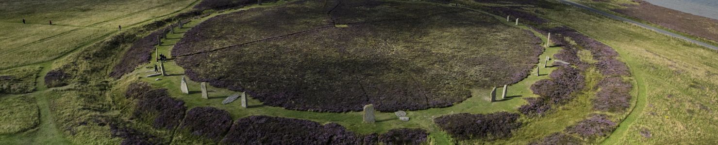
The relationship with the Cuween cairn

The Cuween chambered cairn only stands out against the skyline when viewed from the Stonehall settlement site.
This strongly suggests Cuween and the settlement were linked and that those who lived below were responsible for the construction and use of the cairn.
To Professor Richards, who led the excavations at Stonehall, the passage grave was constructed sometime after the founding of the settlement, perhaps around 3100-3000BC. [3]
Houses Four and Five

Millennia after the Neolithic structures on the mound had gone out of use, two Iron Age buildings were constructed on their ruins. Dating to AD380–550, both were small and circular, with House Four built first, butting up against the rubble filled entrance passage of House Three.
House Five was subsequently built to the south of Four and incorporating it into its fabric. Both structures were lacking in artefacts. [3]
House Six
A two-compartment, Pictish “figure-of-eight” house, dated to AD340-550, was created using the fabric of both Houses Four and Five. Each compartment contained a rectangular hearth but like its predecessors, House Six was found to be lacking in occupational artefacts.
Notes
- [1] Richards, C. and Jones, R. (eds) (2016) The Development of Neolithic House Societies in Orkney: Investigations in the Bay of Firth, Mainland, Orkney (1994–2014). Windgather Press.
- [2] Between 1994 and 2013, the Cuween-Wideford Neolithic Landscape Project, led by Professor Colin Richards, identified and excavated four Neolithic settlements (Stonehall, Smerquoy, Crossiecrown and Wideford Hill) in the vicinity of Wideford Hill, and three others further afield (Varmedale, Muckquoy and the Knowes of Trotty). Another suspected settlement site lies on the eastern side of Wideford Hill.
- [3] Richards, C., Brophy, K., Carruthers, M., Jones, A., Jones, R. and Jones, S. (2016) Good neighbours: Stonehall Knoll, Stonehall Meadow and Stonehall Farm. In Richards, C. and Jones, R. (eds) The Development of Neolithic House Societies in Orkney: Investigations in the Bay of Firth, Mainland, Orkney (1994–2014). Windgather Press, pp. 91-127.
- [4] Davidson, J. L. & Henshall, A. S. (1989). The Chambered Cairns of Orkney. Edinburgh: Edinburgh University Press.
- [5] Childe, V. G. (1946) Scotland before the Scots. Methuen: London.
- [6] Renfrew, C. (1979) Investigations in Orkney. Society of Antiquarians of London (Vol. 38). Thames & Hudson: London.
- [7] Bayliss, A., Marshall, P., Richards, C. and Whittle, A. (2017) Islands of History: The Late Neolithic timescape of Orkney. Antiquity, 91 (359), pp. 1171–1188.


