
Timber, stone and grain – the Braes of Ha’Breck settlement, Wyre


Between 2007 and 2013, excavation by Dr Antonia Thomas and Dan Lee, of the UHI Archaeology Institute, revealed a cluster of five early Neolithic buildings at the Braes of Ha’Breck, Wyre.
They were also able to show that two timber buildings had been replaced by stone structures, like the Wideford Hill settlement on the Orkney Mainland.
The excavations also uncovered middens, work areas and a domestic stone quarry.
Occupation at Ha’Breck began around 3585–3375BC, ending around 3270–2980BC [1]. The site produced Neolithic stone tools, round-based pottery, 15 polished stone axes, macehead fragments and one of the largest charred grain assemblages from a Neolithic context in Scotland.
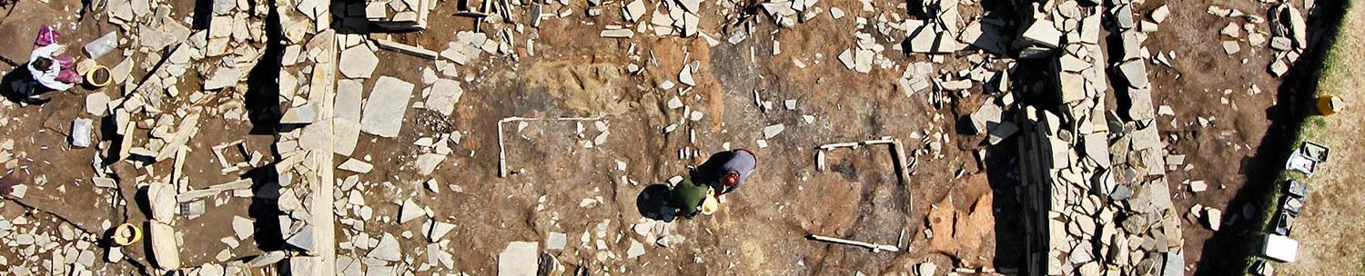
A fieldwalking exercise in 2006 revealed pottery, stone tools and burnt bone. This was followed by geophysical surveys over the area showing the highest concentration of artefacts, which produced clear anomalies suggesting structural elements lay beneath.
As always, geophysics results need to be ground-truthed so excavation began, with evaluation trenches, in 2007.
This revealed extensive midden deposits containing Early Neolithic round-based pottery, flint tools and Skaill knives. A hazelnut shell provided a radiocarbon date of c.3300-3100BC.
The ‘Granary’

As the seasons wore on, the excavators found a paved area and the entrance to a Neolithic structure, House Three:
Like Structure One at the Knap of Howar, the Wyre building had a pinched “waist” with a pair of orthostats projecting from the inner wall, dividing the interior into two sections.

(📷 Antonia Thomas/Dan Lee)
More orthostats created a recess at the northern end and stone furniture features in the southern half. Post-holes in the centre of each of the two sections suggested the roof was supported by a timber framework.
The two central wooden posts had been reworked four or five times, suggesting that the building was occupied for some time. The latest of these posts were left to rot in situ after the rest of the stone building had been dismantled.
At the north end, the earliest phase of activity (dated to 3090-2920BC [3]) was represented by a deep layer of charred barley. This assemblage, which comprises hundreds of thousands of grains, is one of the largest Neolithic cereal assemblages in north-west Europe.
Such was the quantity of grain in House Three, it seems likely the building had an agricultural role as a granary, rather than being a dwelling and may have been a grain store for several different households across the island.
Analysis of the nitrogen and carbon stable isotope values for the grain suggested that it came from crops grown in a range of locations in the surrounding landscape – an early example of communal farming perhaps? [4]

At some point however, disaster struck for this farming community. Substantial chunks of timber charcoal were found in among the burnt grain, suggesting that a catastrophic fire had brought down the northern roof section.
The building’s southern end, however, seemed to have escaped the conflagration and remained in use. Strangely, however, the northern burnt area was not cleared out:
What was going on?

A second stone structure, House Five, was attached to the south-eastern end of House Three – a later extension to the building that also saw a skin of walling added to its eastern side.
Like its neighbour, Five comprised two areas, this time a large “room” (4.8m by 3.2m) and a small, cell-like chamber (c2.2m by 1.32m) at the south-eastern end. A doorway provided access to and from House Three while a second, in the eastern wall, led outside.


A rectangular, stone-built hearth lay at Five’s centre. This, like the example in Structure Five at the Ness of Brodgar, had a stone base, beneath which was a stone-lined channel that ran downslope and out the building’s south-eastern end.
In both these cases the function of the under-hearth channels remains unclear:
The south-eastern cell was entered through the gap between a pair of stone piers projecting from the inner walls. To the excavators, this gave “the impression of a more ‘private’ space.” [2]

(📷 Antonia Thomas/Dan Lee)
The Ha’Breck cell is reminiscent of one found at the Knowes of Trotty, Harray, in 2002. There, a Neolithic building, constructed between 3400BC and 3100BC, saw at least three phases of occupation and alteration during its 200-year lifespan. [5]
One of these phases saw a wall inserted across the interior to create a small chamber at the building’s southern end.
It has been suggested there was a special significance attached to the rear – the innermost area – of Neolithic houses. In the later buildings, this was perhaps marked by the construction of the so-called “dressers”, the best surviving examples of which can be seen at Skara Brae.
It may be that the rear cells in earlier Neolithic dwellings were a precursor to the “dressers” – a sacred, or special, area that “endured, developing into the ‘dressers’ or house altars…” [5]
Houses Three and Five went out of use in prehistory, the entrance to Three sealed with clay before midden was deposited along its eastern side.

Timber phase

It was during investigations into the eastern midden layers outside Three that 14 post-holes were exposed. These belonged to a timber structure, House Four, that pre-dated Three and Five.
Measuring 5.8m by 3.8m, this rectangular building was built around a central, scoop hearth. A radiocarbon date from a charred hawthorn nut confirmed that House Four was raised/used in the last few centuries of the fourth millennium BC.
The evidence, however, suggested it had a short lifespan.
A second rectangular, post-built structure was found a few metres to the north. Christened House One, it too was only used for a short time before being dismantled and replaced by a stone building, House Two.
Although the new stone structure was built on the footprint of its predecessor, the timber dwelling’s hearth was not reused but replaced with a new, slightly off-centre, stone hearth.

(📷 Antonia Thomas/Dan Lee)
The quarry and work area

In 2010, work to investigate another geophysical anomaly revealed a two-metre-deep quarry that was probably the source of building material used for the stone structures:
This showed that the Wyre farmers were exploiting this stone source at the same time as they were building houses in wood.
The upper levels of the quarry – which produced Grooved ware pottery and flaked stone tools – were dated to the end of the third millennium BC or the very end of the Orcadian Neolithic. The quarry was therefore backfilled over a period of some 1,500 years, during the very time that many narratives suggest that people were turning to flagstone as a substitute for timber.
The sequence of building in wood and stone suggests that the choice of building material was far more complicated than just a simple transition from wood to stone. [6]

Just metres from the quarry, excavation revealed a rammed-stone floor, containing burnt stone and tools. This was interpreted as workspace for the manufacture of stone tools and produced hammerstones, flint debitage and sherds of round-based pottery.
The Ha’Breck dead…
Although the excavations at the Braes of Ha’Breck painted a vivid picture of everyday Neolithic life in Wyre, it also left us with an intriguing puzzle. What were the islanders doing with their dead?
Wyre is one of the few islands in Orkney without a chambered cairn. At least one that has survived in any recognisable form…
But elsewhere, very few excavated “houses of the dead” in Orkney actually contained human remains, and even among those, the quantity could not be regarded as representative of an entire community over an extended period of time. From that it seems that not everybody ended up within a chambered cairn. And those who did might not have remained there!
So what was happening in Wyre? Were they transporting their dead to the neighbouring island of Rousay, which has 15 known “tombs”? Or were they treating them in ways that have made their remains inaccessible or invisible to us.
Were they cremated? Buried? Or perhaps deposited at sea or in bodies of water? Recent excavation has also confirmed that individual burials in stone cists occurred in Neolithic Orkney.
Are we yet to find a cist cemetery in Wyre? Or the denuded, or dismantled, remains of a chambered cairn or two?
Time will tell.
Notes
- [1] Bayliss, A., Marshall, P., Richards, C. and Whittle, A. (2017) Islands of history: the Late Neolithic timescape of Orkney. Antiquity, 91(359), 1171-1188.
- [2] Lee, D. and Thomas, A. (2012) Orkney’s First Farmers – Neolithic Settlement on Wyre. In Current Archaeology. July 2012.
- [3] Garrow, D., Griffiths, S., Anderson-Whymark, H. & Sturt, F. (2017) Stepping stones to the Neolithic? Radiocarbon dating the Early Neolithic on islands within the ‘western seaways’ of Britain. Proceedings of the Prehistoric Society 83: 97–135. https://doi.org/10.1017/ppr.2017.4
- [4] Bishop, R.R., Gröcke, D.R., Ralston, I., Clarke, D.V., Lee, D., Shepherd, A., Thomas, A., Rowley-Conwy, P.A. & Church, M.J.(2022). Scotland’s first farmers: new insights into early farming practices in North-West Europe. Antiquity, 1-18. https://doi.org/10.15184/aqy.2022.107
- [5] Downes, J., Sharman, P., Challands, A., Guttman-Bond, E., McKenzie, J., Towers, R. and Voke, P.D. (2016). Place in the Past: an early Neolithic house at the Knowes of Trotty barrow cemetery, Harray, Mainland, Orkney. In Richards, C. and Jones R. (eds) The Development of Neolithic House Societies in Orkney. pp.41-63. Oxbow: Oxford.
- [6] Farrell, M., Bunting, M. Jane, Lee, D.H.J. & Thomas, A. (2014). Neolithic settlement at the woodland’s edge: palynological data and timber architecture in Orkney, Scotland. Journal of Archaeological Science 51, 225-236. https://doi.org/10.1016/j.jas.2012.05.042


