
Vestrafiold – the enclosure

By Sigurd Towrie

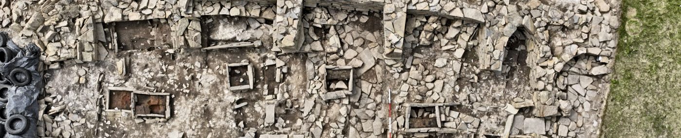
On the lower slopes of Vestrafiold, south-west of the megalithic quarry, are the remains of a large, possibly prehistoric, enclosure.
Covering an area of around seven acres (2.8 hectares), the oval feature was defined by a “wall” of upright flagstones running around its perimeter. Little is known about the site, which, in terms of construction, “is completely unlike any other enclosure in Orkney”. [1]
It was first recorded by the parish minister, Rev Charles Clouston, in 1845:
A few years later, in 1851, Lieutenant F.W.L. Thomas visited Orkney and wrote:

“No reason can be detected for choosing such a site; the greater part of the area, I should imagine, has always been very swampy; on the north-west side the line of demarcation runs up and along a rather steep brae (perhaps twenty feet higher than the average level).
Thomas’ antiquaries were presumably busy with more promising sites and it remained uninvestigated.
On saying that, I found one reference relating to the Orkney antiquarian James Walls Cursiter, who had “made a careful examination of the area” around 1910 and declared that a “circle three times the diameter of the Brodgar Circle in Stenness may be plainly traced.”
The writer of a letter to The Scotsman newspaper in September 1910, concluded:
Having not seen the results of Cursiter’s survey, nor his conclusions, in print, I can’t comment much on his claims, other than to say that it is unlikely.
I suspect he was mistaking the surviving boundary stones as megaliths – a conclusion perhaps bolstered by the presence of a known standing stone quarry, and prone megaliths, further up the hill.
Deterioration
By 1924, although it was still visible, the enclosure was clearly deteriorating:
Having no defensive value, Fraser pondered whether the enclosure was to contain livestock, but the low, c0.6-metre-high “walls” makes this unlikely:
Unless the flagstones were once supplemented by timber posts or “fencing”, they clearly served no practical purpose. Instead, they may have had a more symbolic role, perhaps demarcating an area considered significant, or taboo, for other reasons.
A notable fact about the enclosed area, mentioned by neither Thomas nor Fraser, is that it contained huge quantities of the glassy, burnt material known locally as cramp.
Cramp is an Orcadian dialect word, defined as “small heaps of vitrified glass and stones found in ancient tumuli.” [4]
It is a vitreous, lightweight material that is “vesicular in texture and generally of a light grey colour”[5]. Because cramp it is often found stuck to burnt bone it has generally become associated with Bronze Age cremations.
In 1936, describing two sites in the same parish where cramp was abundant, Callander wrote:
This ties in with a brief comment by George Marwick from 1892:
The presence of huge quantities of cramp suggests the enclosure is Bronze Age and was perhaps the site of cremation on an incredible scale. A Bronze Age date is also supported by the presence of a barrow cemetery on Vestrafiold’s summit.
However, cramp is also found in the Neolithic, with large chunks found in the central hearth at the Stones of Stenness and the roughly contemporary, open-air fireplace about 150 metres to the south-west of the Barnhouse settlement. These were interpreted as the residue of large-scale feasting events. [6]

Cramp deposited at two quarried megaliths on Vestrafiold may well relate to the same, although the fieldwork found no evidence of in situ burning in the vicinity. This led to the suggestion that the large piece of cramp between the two prone megaliths was deliberately placed after their abandonment. [7]
At the Ness of Brodgar site a large spread of cramp was encountered in Trench X in 2019. Associated with this deposit were pottery sherds with incised decoration and a macehead.

Returning to the Vestrafiold enclosure, the lack of archaeological information means its date and purpose remain open to debate.
While the quantity of cramp recorded in the area is suggestive of large-scale Bronze Age cremation, its association with a known megalithic quarry – which may have been the source for the stone used in its construction – could indicate the enclosure is much earlier.
The presence of at least one mound within could also hint at a Neolithic origin but, unfortunately, this four-metre-diameter tumulus was long gone by 1967.
Professor Colin Richards has pointed out the similarities to the enclosure recorded at the Stones of Via and which surrounded a possible chambered cairn [6]. The Stones of Via, however, is also undated so it will require further investigation to establish what, if anything, linked the two, not to mention what they represent.
Notes
- [1] Richards, C. (2003) Report of the field survey at the quarry site of Vestrafiold, Sandwick, Mainland, Orkney.
- [1b] Clouston, C. (1845) New Statistical Account Vol 15.
- [2] Thomas, F.W.L. (1851) Account of some of the Celtic Antiquities of Orkney, including the Stones of Stenness, Tumuli, Picts-houses, &c., with Plans, by FWL Thomas, RN, Corr. Mem. SA Scot., Lieutenant Commanding HM Surveying Vessel Woodlark. Archaeologia, 34(1), pp.88-136.
- [3] Fraser, J. (1924) Some antiquities in Sandwick Parish. Proceedings of the Orkney Antiquarian Society. Volume 2, 22-29.
- [4] Edmonston, T. (1866) An Etymological Glossary of the Shetland and Orkney Dialect with some derivations of names of places in Shetland. Edinburgh.
- [5] Callander, J.G. (1936) Bronze Age urns of clay from Orkney and Shetland, with a note on vitreous material called ‘cramp’. In Proceedings of the Society of Antiquaries of Scotland (Vol. 70, pp. 441-452).
- [5b] Marwick, G. (1892) The Standing Stones of Stenness – Traces of the Ancient Road from the Quarries. In Muir, T. and Irvine, J. (eds) 2014. George Marwick: Yesnaby’s Master Storyteller. The Orcadian: Kirkwall.
- [6] Challands, A., Edmonds, M. and Richards, C. (2005) Beyond the Village: Barnhouse Odin and the Stones of Stenness. In Richards, C. (ed) Dwelling among the monuments: the Neolithic village of Barnhouse, Maeshowe passage grave and surrounding monuments at Stenness. Cambridge: McDonald Institute for Archaeological Research, pp. 205–227.
- [7] Richards, C., Brown, J., Jones, S., Hall, A. and Muir, T. (2013) Monumental Risk: megalithic quarrying at Staneyhill and Vestrafiold, Mainland, Orkney. In Richards, C. (ed) Building the Great Stone Circles of the North.


